Home >
The Atlantic cable route across the ocean... Decline & fall of the Confederacy...

The Atlantic cable route across the ocean... Decline & fall of the Confederacy...
Item # 701658
August 05, 1865
NEW YORK TRIBUNE, Aug. 5, 1865
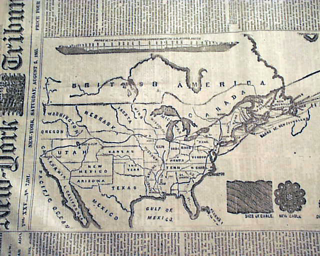
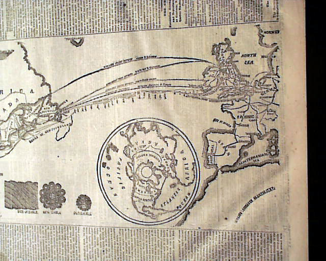
* Atlantic cable route - U.S. map
* Southern Confederacy no more
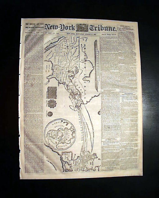
Certainly the graphic appeal of this issue is the very large map showing the route of the Atlantic cable across the Atlantic Ocean, which also presents a nice map of the United States at this time with most of the area west of the Mississippi still as territories. Curiously there is no related text.
Much of the text on the front page is a great overview of the Civil War with: "The Decline and Fall of The Southern Confederacy" "An Inside View" "Richmond A Year Ago".
Eight pages, very nice condition.
background: The 1865 Atlantic Cable was a major attempt to lay a permanent telegraph cable across the Atlantic Ocean, connecting Europe and North America. Led by British engineer Sir Charles Tilston Bright and American financier Cyrus Field, the effort used the massive steamship Great Eastern, then the largest ship in the world. The cable was laid from Valentia, Ireland, toward Newfoundland, but after over 1,000 miles had been successfully placed, the cable snapped and was lost in the deep ocean. Despite the failure, the expedition demonstrated the feasibility of transatlantic telegraphy. The project was successfully completed the following year with the 1866 cable, which permanently connected the continents and revolutionized global communication.
Category: The Civil War
Available Now
$74.00