Home >
Civil War map of the New Orleans vicinity...

Civil War map of the New Orleans vicinity...
Item # 705684
Currently Unavailable. Contact us if you would like to be placed on a want list or to be notified if a similar item is available.
October 27, 1861
NEW YORK HERALD, Oct. 27, 1861
* Lower Mississippi River - New Orleans
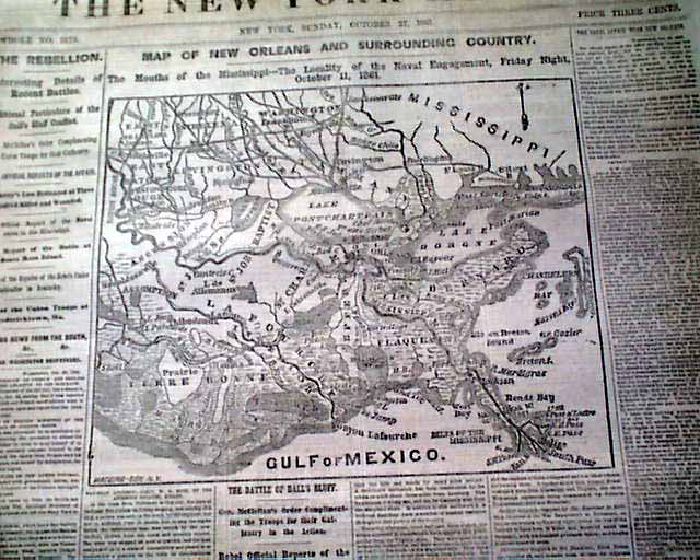
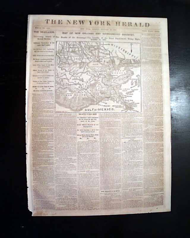
Much of the front page is taken up with a large & extremely detailed Civil War map headed: "Map Of Orleans And Surrounding Country...".
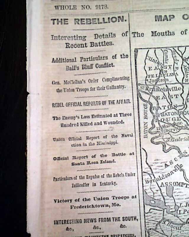
Among the front page column heads on the war are: "THE REBELLION" "Additional Particulars of the Ball's Bluff Conflict" "Rebel Official Reports of the Affair" "The Battle of Balls Bluff" and much more.
Eight pages, tiny loss at the bottom of the blank spine, very nice condition.
AI notes: The October 27, 1861, issue of the New York Herald is notable for carrying a detailed Civil War map of the New Orleans region, produced at a moment when the Union was increasingly focused on the Mississippi River and the strategic value of the Gulf Coast. Although New Orleans would not fall until April 1862, the Herald—the nation’s largest-circulation newspaper—used such maps to help readers visualize potential Union naval and military operations against the Confederacy’s most important port. The map typically highlighted the lower Mississippi River, surrounding bayous, Lake Pontchartrain, Forts Jackson and St. Philip, and key waterways leading to the city, emphasizing how control of river approaches could isolate New Orleans economically and militarily. These cartographic supplements reflected the Herald’s aggressive war coverage under editor James Gordon Bennett Sr., blending journalism with strategic illustration to shape Northern public understanding of where the war might turn next.
Category: Yankee
No Longer Available