Home > Back to Search Results >
Very large Civil War map shows the Beaufort vicinity...
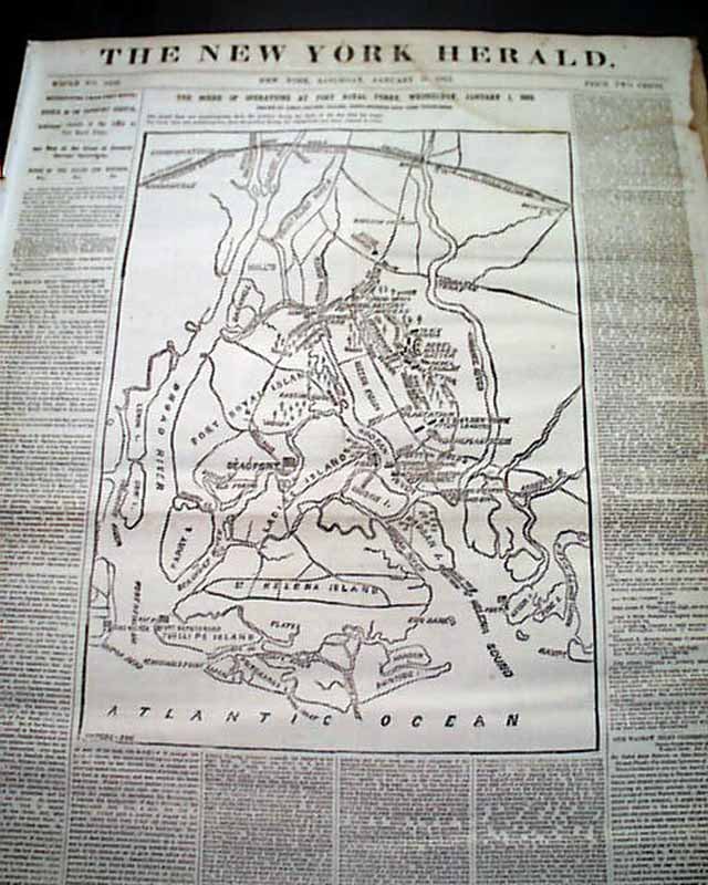
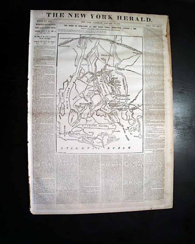
Very large Civil War map shows the Beaufort vicinity...
Item # 705396
January 11, 1862
NEW YORK HERALD, Jan. 11, 1862
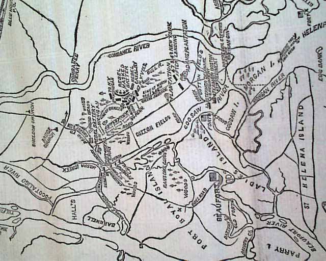
* Battle of Port Royal Ferry w/ map
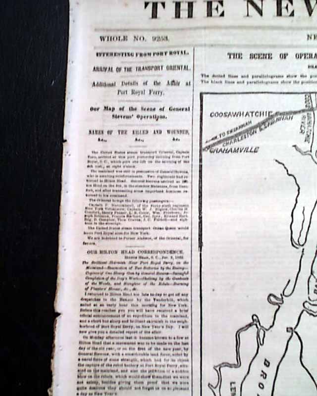
Most of the front page is taken up with a huge Civil War map headed: "The Scene Of Operations at Port Royal Ferry..." with a subhead. The map shows much detail of the Beaufort vicinity.
There are also first column heads: "Additional Details of the Affair at Port Royal Ferry" and "Our Map of the Scene of General Stevens' Operations" & others.
Eight pages, stains to a portion of the right margins, generally good condition.
background: The Battle of Port Royal Ferry, fought on January 1, 1862, was a sharp engagement on South Carolina’s Port Royal Island that helped solidify Union control of the coastal region after their earlier victory at Port Royal Sound. Brig. Gen. Isaac I. Stevens led about 3,000 Union troops from Beaufort toward the Coosaw River, aiming to destroy Confederate positions guarding the ferry crossing and disrupt communication lines between Charleston and Savannah. Supported by Union gunboats including the Ottawa and Pembina, which shelled Confederate artillery emplacements along the river, Stevens’s men advanced through marshy ground and clashed with several hundred Confederates under Col. James Jones. The Confederate defenders put up resistance with field guns and musket fire but, unable to withstand the combined land and naval assault, withdrew in good order, leaving the ferry and surrounding area in Union hands. The Union victory secured a vital crossing, further isolated Confederate forces on the South Carolina mainland, and demonstrated the effectiveness of joint Army-Navy operations in the Sea Islands campaign.
Category: Yankee
Available Now
$58.00