Home >
Map shows details of Columbus, Kentucky...
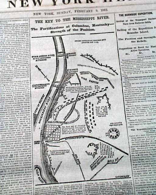
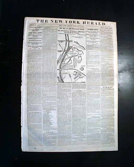
Map shows details of Columbus, Kentucky...
Item # 704752
February 09, 1862
NEW YORK HERALD, Feb. 9, 1862
* Columbus, Kentucky Confederate fortifications map
The front page features a nice and detailed map headed: "The Key To The Mississippi River. The Fortifications at Columbus, Kentucky--Strength of the Position."
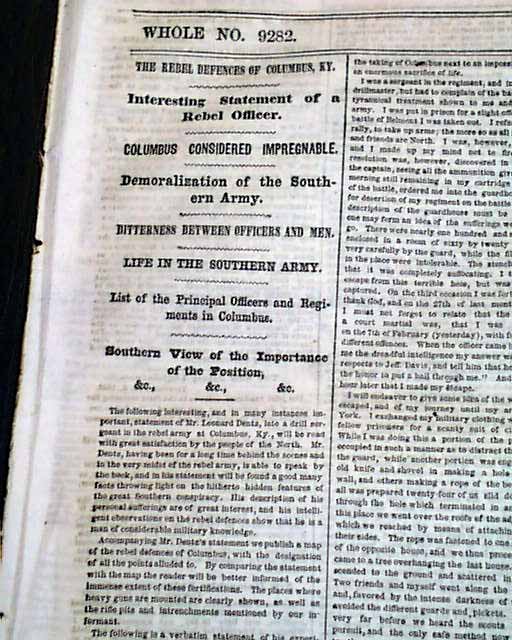
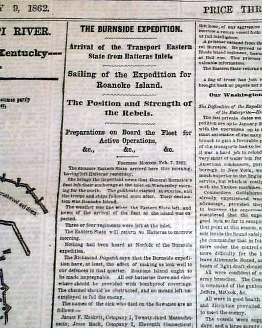
The balance of the front page is taken up with various Civil War reports with column heads including: "The Rebel Defences of Columbus" "Columbus Considered Impregnable" "Demoralization of the Southern Army" "Bitterness Between Officers and Men" "Life in the Southern Army" "The Burnside Expedition" "Sailing of the Expedition for Roanoke Island" "The Position & Strength of the Rebels" and more.
Eight pages, nice condition.
wikipedia notes: Confederate General Leonidas Polk fortified the area now occupied by the park beginning September 3, 1861. The fort at Columbus was built upon a bluff along the "cutside" of the river. The fort was christened Fort De Russey, after an engineer supervising the construction of fortifications, but Polk referred to it as the "Gibraltar of the West". He had equipped it with a massive chain that stretched across the Mississippi to Belmont, Missouri, to block the passage of U.S. gunboats and supply vessels to and from destinations in the western theaters of the war. Equipped also with 143 cannons, Columbus was the northernmost Confederate base along the Mississippi, protecting Memphis, Tennessee, Vicksburg, Mississippi, and other critical Conferate-held territory. As the northern terminus of the Mobile and Ohio Railroad, Columbus was logistically tied to Confederate supply lines.
Category: Yankee
Available Now
$48.00