Home >
Oswego in the French & Indian War... Large map of Europe... Judaica item...


Oswego in the French & Indian War... Large map of Europe... Judaica item...
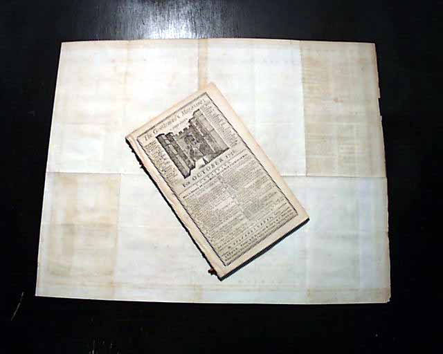
Item # 694426 THE GENTLEMAN'S MAGAZINE, London, October, 1756
* Great & quite large map of Europe
* Oswego - French & Indian War
* Judaica - Jewish content
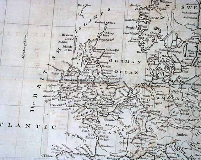
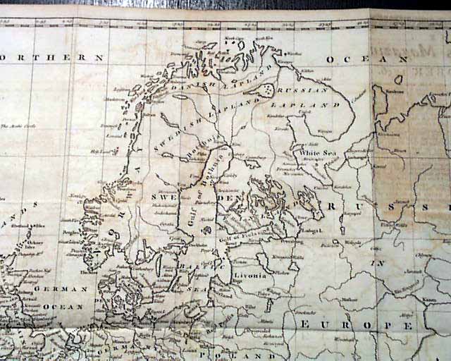
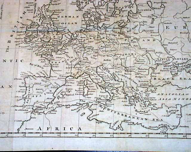
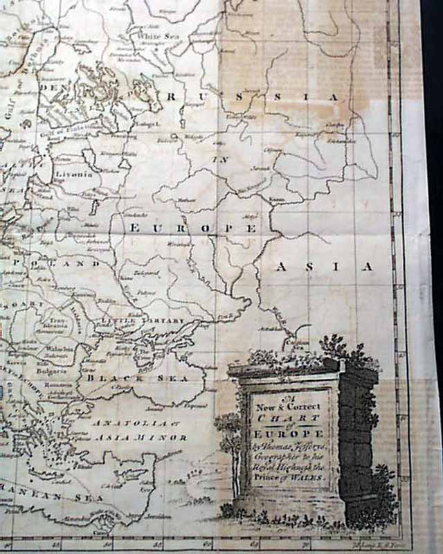
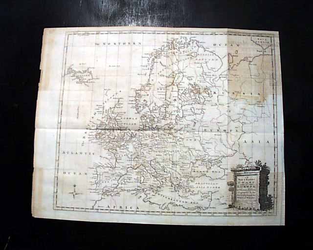
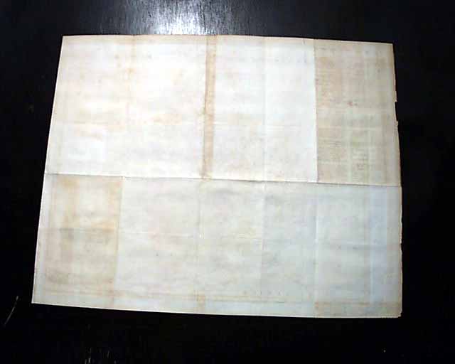
The prime feature would be the very nice & large foldout map titled in the cartouche: "A New & Correct CHART of EUROPE..." which shows all of Europe as well as Iceland, Russia, North Africa, and parts of the Middle East including Jerusalem, Joppa, Cairo, & Cyprus. This map measures 13 1/4 by 16 1/2 inches, margins being sufficiently wide. There is some off-setting of ink in the two right corners, from having been folded into itself for over 250 years. Otherwise in excellent condition.
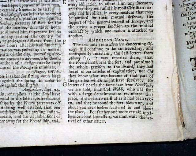
Under the heading near the back: "American News" is a report which includes: "...concerning Oswego still continue to be contradictory...the last letters from Albany say that the French had burnt the fort & put almost the whole garrison to the sword..." and mention that Col. Webb was sent to reinforce the place & found the fort blown up & found "...about 500 dead bodies scattered in & about the place...". Not a lengthy report yet historically important.
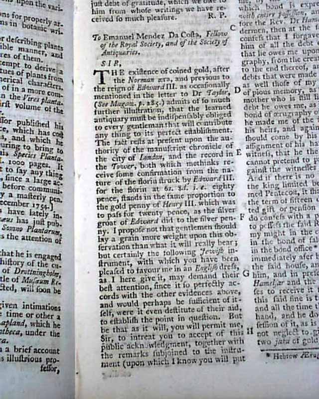
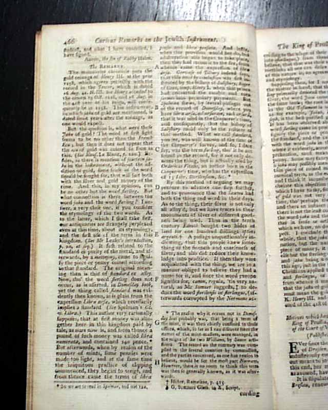
Also of interest is an article: "Curious Jewish Instrument from the Hebrew" which takes nearly half a page & is signed: Aaron, the son of Rabby Haim.
Complete in 48 pages with a full title/contents page featuring an engraving of St. John's Gate, 5 by 8 1/4 inches, very nice condition. The map is the only plate called for in this issue.
A very nice War magazine from during the French & Indian War from the "mother country" with a wide range of varied content. This was the first periodical to use the word "magazine" in its title, having begun in 1731 and lasting until 1907.
Category: The 1600's and 1700's
Available Now
$180.00