Home > Back to Search Results >
Great foldout map of Boston & vicinity... Early reports on the Revolutionary War...
Great foldout map of Boston & vicinity... Early reports on the Revolutionary War...
Item # 677956
GENTLEMAN'S MAGAZINE, London, October, 1775
* Early events of the Revolutionary War
* Early map of the Boston, Massachusetts area
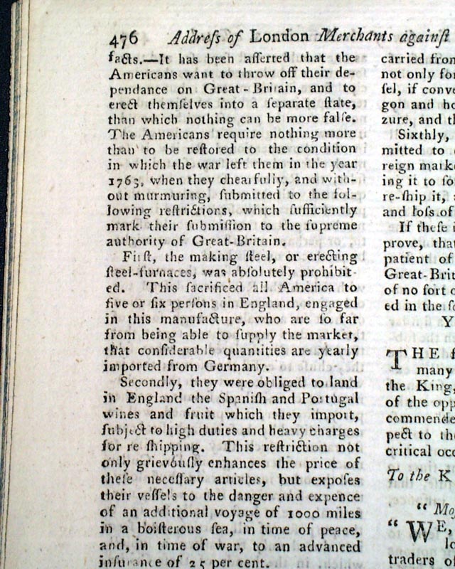
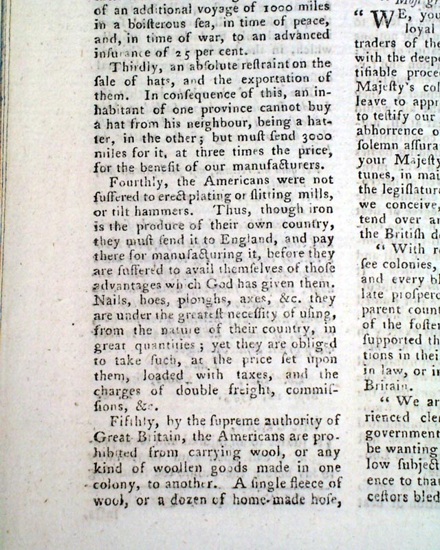
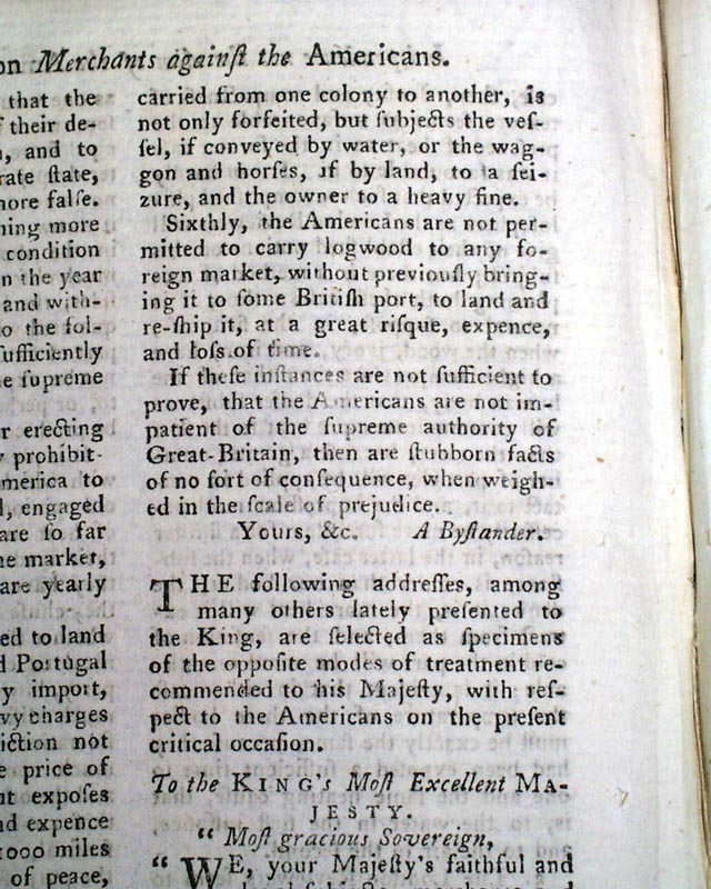
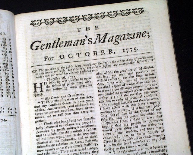
The first several pages contain a nice account of Parliamentary discussion concerning the troubles in America, a portion including: "...the rebellious war now levied is become more general, & is manifestly carried on for the purpose of establishing an independent empire. I need not dwell upon the fatal effects of the success of such a plan..." with much more.
Another article headed: "Independence not the Aim of the Americans, Asserted." takes three-quarters of a page. In retrospect, such a view seems quite naive.
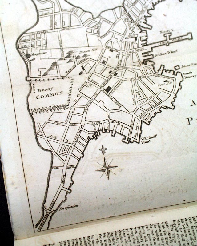
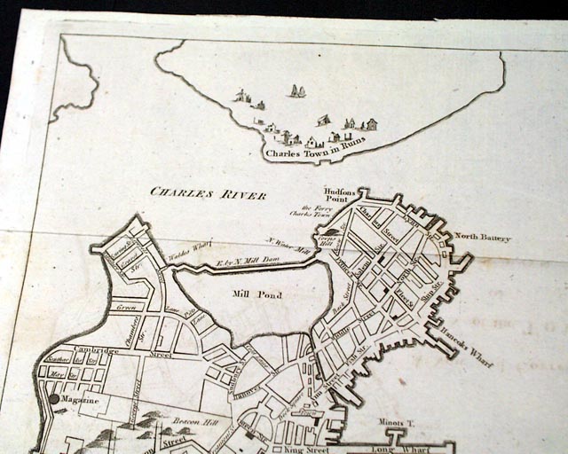
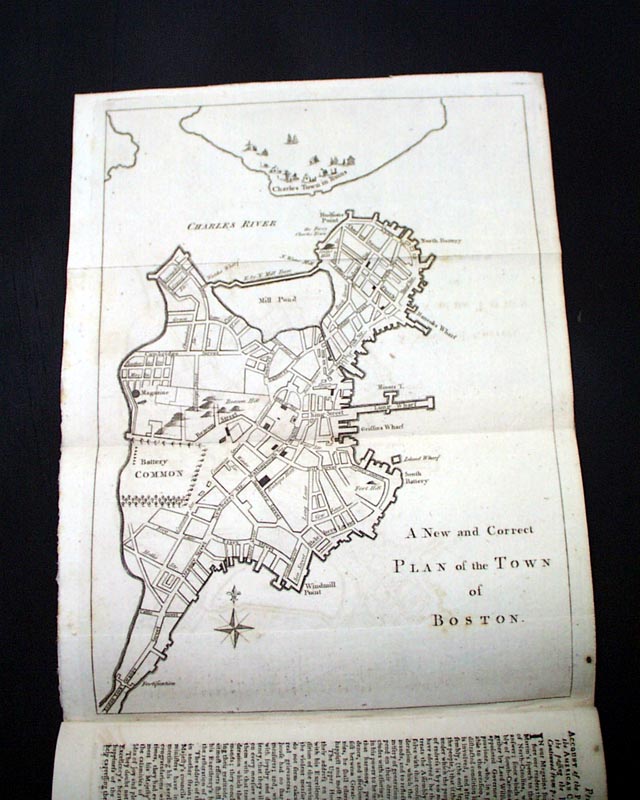
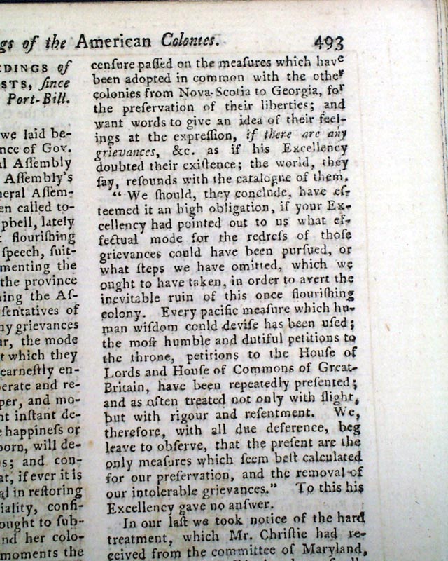
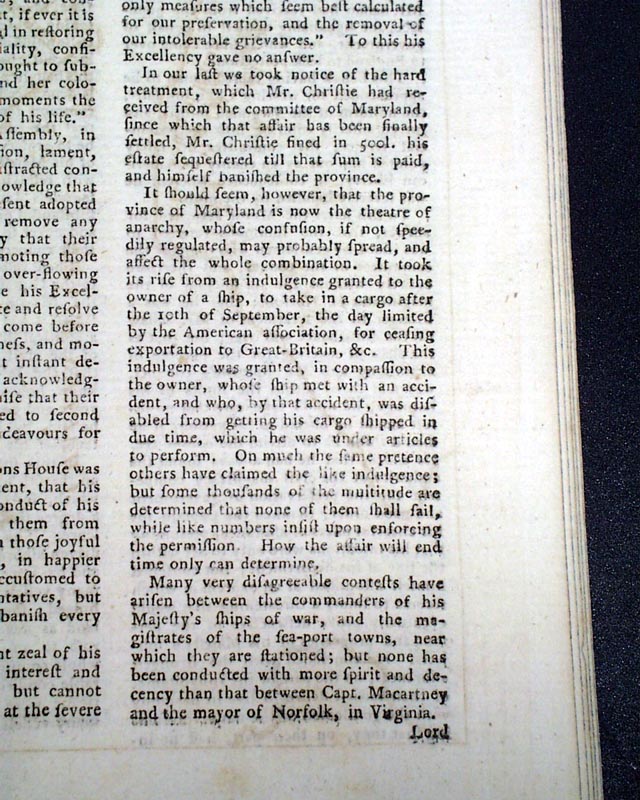
But the prime feature of this issue is certainly the very nice (and often missing) foldout map titled: "A New and Correct Plan of the Town of Boston" with much detail including many of the streets. Also shown at the top is "Charles Town in ruins." (see photos) This map measures about 8 1/4 by 10 1/2 inches & in uncommonly nice, clean condition.
This map is accompanied by a related article titled: "Account of the Proceedings of the American Colonists since the Passing the Boston Port-Bill" which takes over 3 pages.
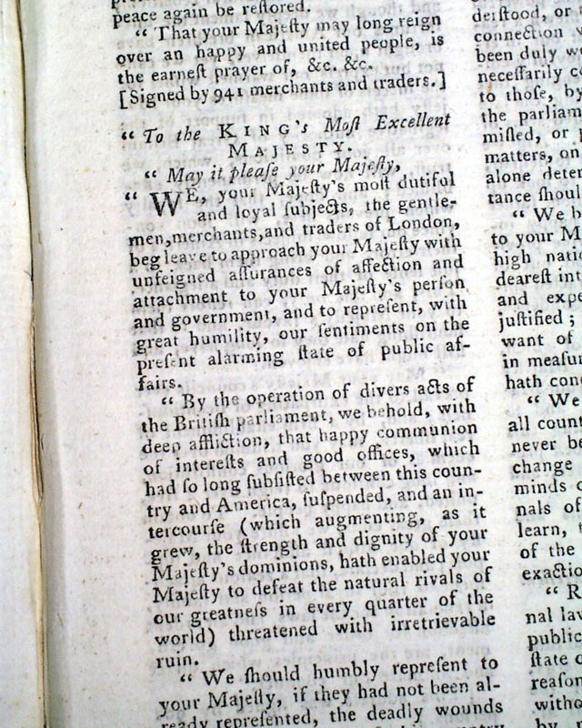
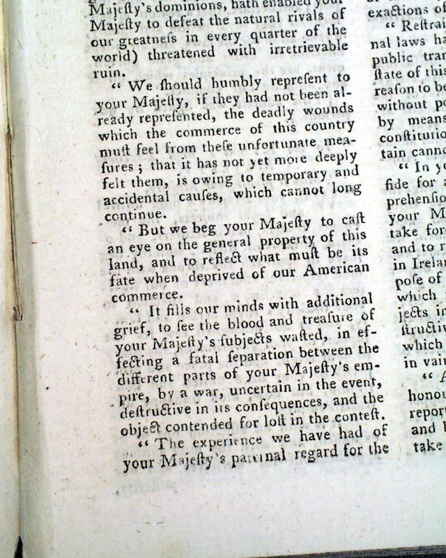
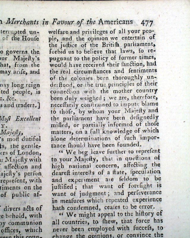
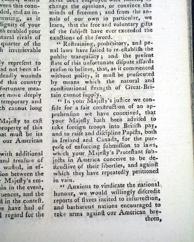
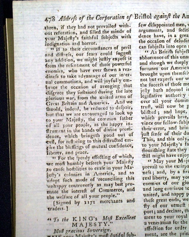
There are several letters on modes of treatment of the Americans "on the present critical occasion". Other related articles are headed: "Petition of Bristol Merchants in Favour of the Americans." and "Account of the Proceedings of the American Colonists..." this latter article taking over 3 pages.
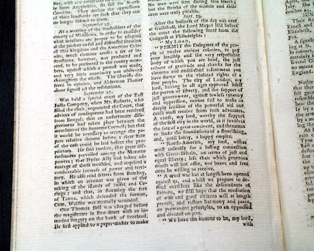
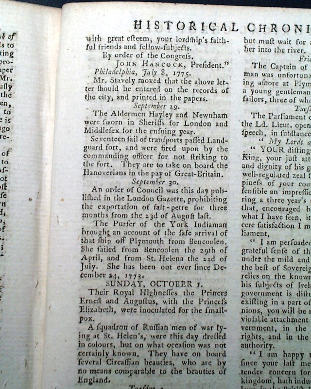
Within the "Historical Chronicle" near the back is a letter to the London Lord Mayor from the Congress at Philadelphia which is signed in type: John Hancock, President taking over half a column and includes: "...a cruel war has at length been opened against us, & whilst we prepare to defend ourselves...we still hope that the mediation of wise & good citizens will at length prevail & restore harmony & peace...", but of course this would not happen.
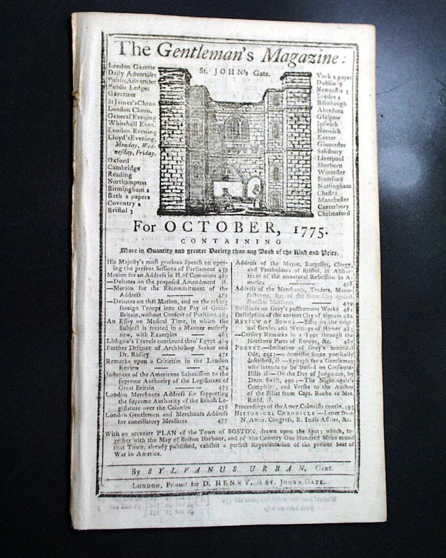
Complete in 48 pages, full title/contents page featuring an engraving of St. John's Gate, 5 by 8 1/4 inches, great condition.
AI notes: An 18th-century map of Boston, such as those published around 1775, offers a detailed view of the city’s layout just before the American Revolution, capturing its narrow, winding streets, densely packed buildings, and the bustling harbor along the Charles River. These maps often highlight key landmarks like the Boston Common, Faneuil Hall, the Old State House, and the wharves that were central to trade and daily life, as well as the locations of fortifications and artillery positions reflecting the tense political climate. Surrounding areas—including Roxbury, Charlestown, and Dorchester—are shown with roads connecting them to the city center, along with hills, rivers, and marshlands that influenced both settlement and military strategy. Some editions also indicate property boundaries, prominent churches, and public squares, providing not only a geographic reference but also a social and economic snapshot of colonial Boston, illustrating the dense urban fabric and strategic significance of the city in the Revolutionary era.
* Early events of the Revolutionary War
* Early map of the Boston, Massachusetts area
The first several pages contain a nice account of Parliamentary discussion concerning the troubles in America, a portion including: "...the rebellious war now levied is become more general, & is manifestly carried on for the purpose of establishing an independent empire. I need not dwell upon the fatal effects of the success of such a plan..." with much more.
Another article headed: "Independence not the Aim of the Americans, Asserted." takes three-quarters of a page. In retrospect, such a view seems quite naive.
But the prime feature of this issue is certainly the very nice (and often missing) foldout map titled: "A New and Correct Plan of the Town of Boston" with much detail including many of the streets. Also shown at the top is "Charles Town in ruins." (see photos) This map measures about 8 1/4 by 10 1/2 inches & in uncommonly nice, clean condition.
This map is accompanied by a related article titled: "Account of the Proceedings of the American Colonists since the Passing the Boston Port-Bill" which takes over 3 pages.
There are several letters on modes of treatment of the Americans "on the present critical occasion". Other related articles are headed: "Petition of Bristol Merchants in Favour of the Americans." and "Account of the Proceedings of the American Colonists..." this latter article taking over 3 pages.
Within the "Historical Chronicle" near the back is a letter to the London Lord Mayor from the Congress at Philadelphia which is signed in type: John Hancock, President taking over half a column and includes: "...a cruel war has at length been opened against us, & whilst we prepare to defend ourselves...we still hope that the mediation of wise & good citizens will at length prevail & restore harmony & peace...", but of course this would not happen.
Complete in 48 pages, full title/contents page featuring an engraving of St. John's Gate, 5 by 8 1/4 inches, great condition.
AI notes: An 18th-century map of Boston, such as those published around 1775, offers a detailed view of the city’s layout just before the American Revolution, capturing its narrow, winding streets, densely packed buildings, and the bustling harbor along the Charles River. These maps often highlight key landmarks like the Boston Common, Faneuil Hall, the Old State House, and the wharves that were central to trade and daily life, as well as the locations of fortifications and artillery positions reflecting the tense political climate. Surrounding areas—including Roxbury, Charlestown, and Dorchester—are shown with roads connecting them to the city center, along with hills, rivers, and marshlands that influenced both settlement and military strategy. Some editions also indicate property boundaries, prominent churches, and public squares, providing not only a geographic reference but also a social and economic snapshot of colonial Boston, illustrating the dense urban fabric and strategic significance of the city in the Revolutionary era.
Category: Revolutionary War
Available Now
$455.00