Home >
1770 Canada North America Map...
1770 Canada North America Map...
Item # 206841
Currently Unavailable. Contact us if you would like to be placed on a want list or to be notified if a similar item is available.
March 01, 1790
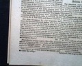
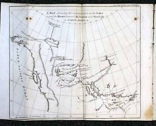
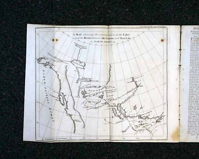
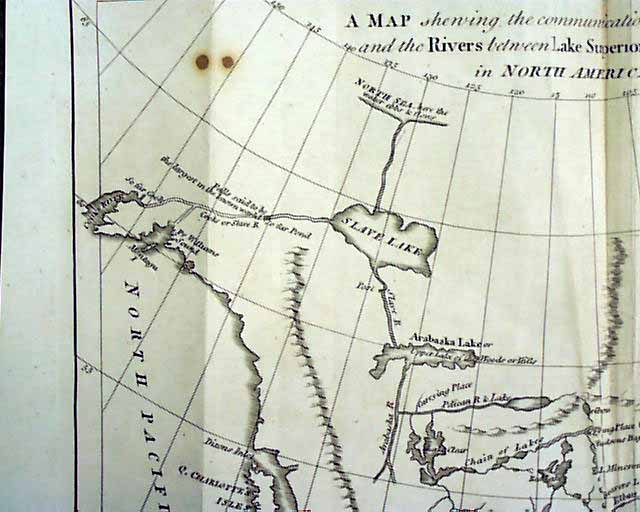
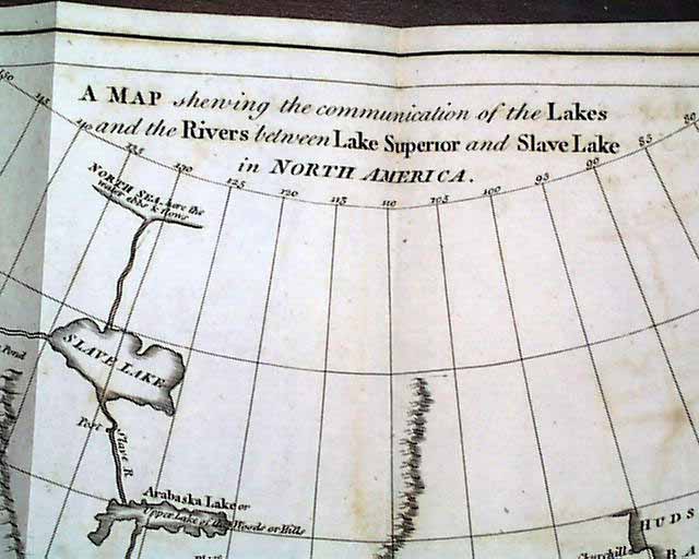
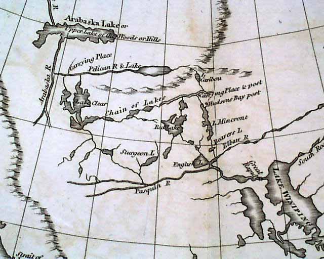
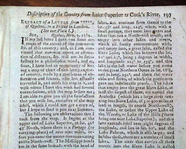
GENTLEMANS MAGAZINE, London, March, 1790 This issue features a nice, attached fold-out map (see photo): "A Map showing the communication of the Lakes and the Rivers between Lake Superior and Slave Lake in North America." Shows the extreme western parts of Lake Superior and "Hudsons Bay", "Lake Winiping (now Lake Winnipeg in Manitoba) and other landmarks across what is now Saskatchewan, Alberta and British Columbia, to "Queen Charlottes Island". Northern and northwestern points shown include Slave Lake in what is now the Northwest Territories, "Pr. William Sound" and Cooks River (both in Alaska). There is also a lengthy extract of a letter about the region: "Description of the Country from Lake Superior to Cooks River" which takes 2 1/2 pgs. Map measures about 8 1/4 by 10 1/4 inches with the margins. Map has just a few traces of very lite foxing. Issue is octavo-size, 94 pgs., with a full title/index pg., and an engraving of St. Johns Gate in the masthead. Has occasional foxing, otherwise in very good condition.
Category: Pre-Civil War
No Longer Available