
Four Civil War maps, one consumes a full page...
Item # 693865
May 09, 1863
NEW YORK HERALD, May 9, 1863
* New York Harbor defenses
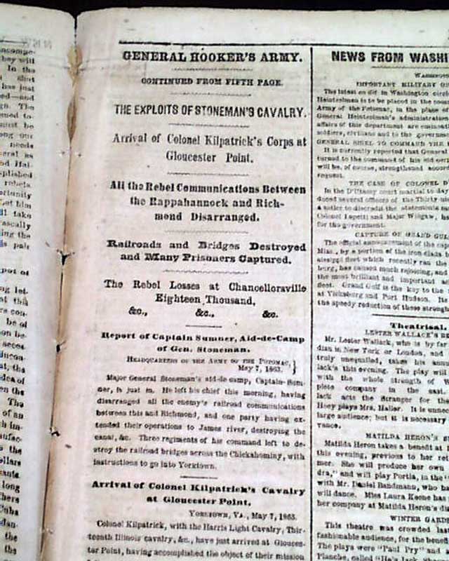
* Battle of Chancellorsville - Virginia
* Four American Civil War maps
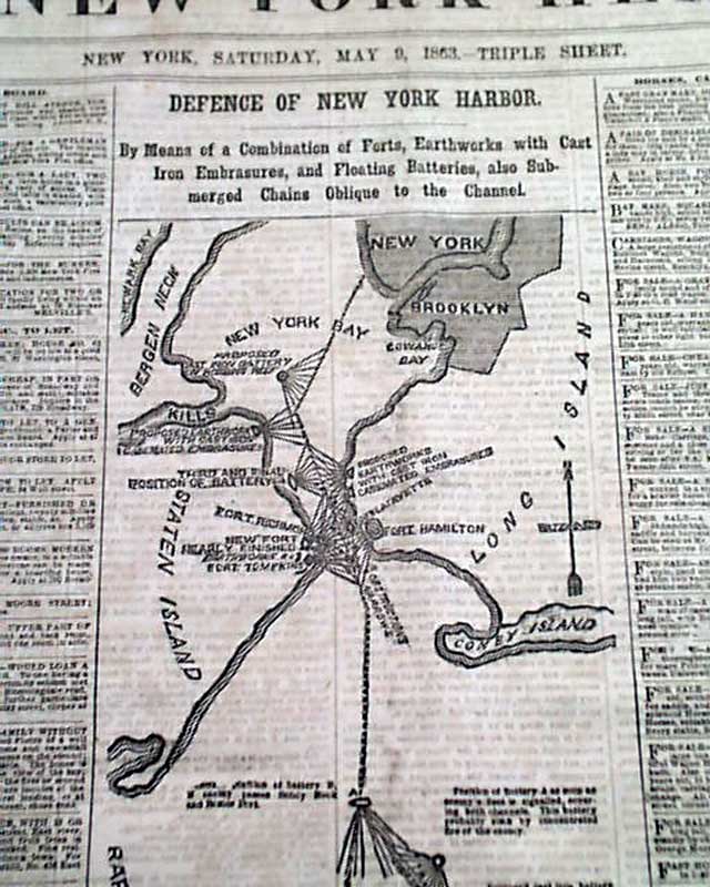
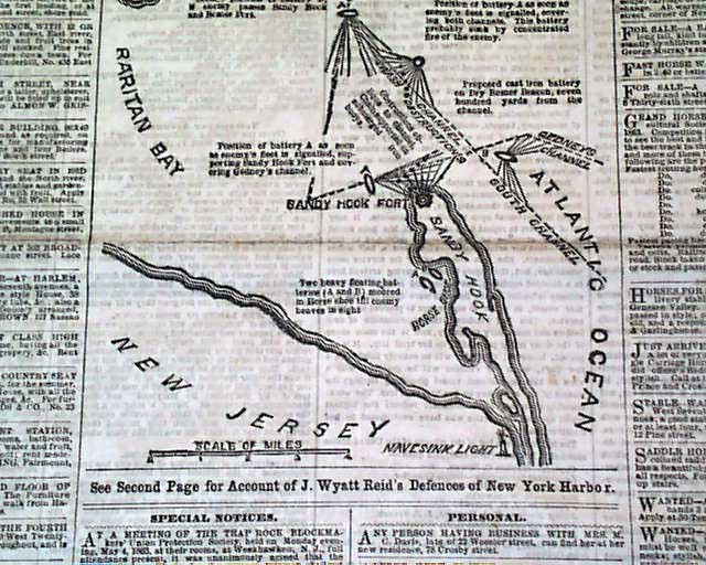
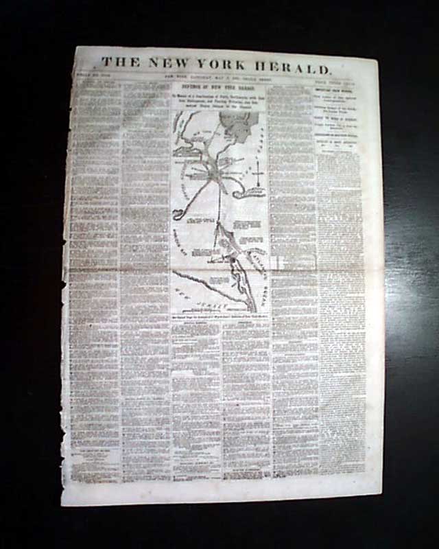
The front page features a nice & very detailed Civil War map headed: "DEFENSE OF NEW YORK HARBOR" which shows Sandy Hook, Brooklyn, Coney Island, Staten Island and more.
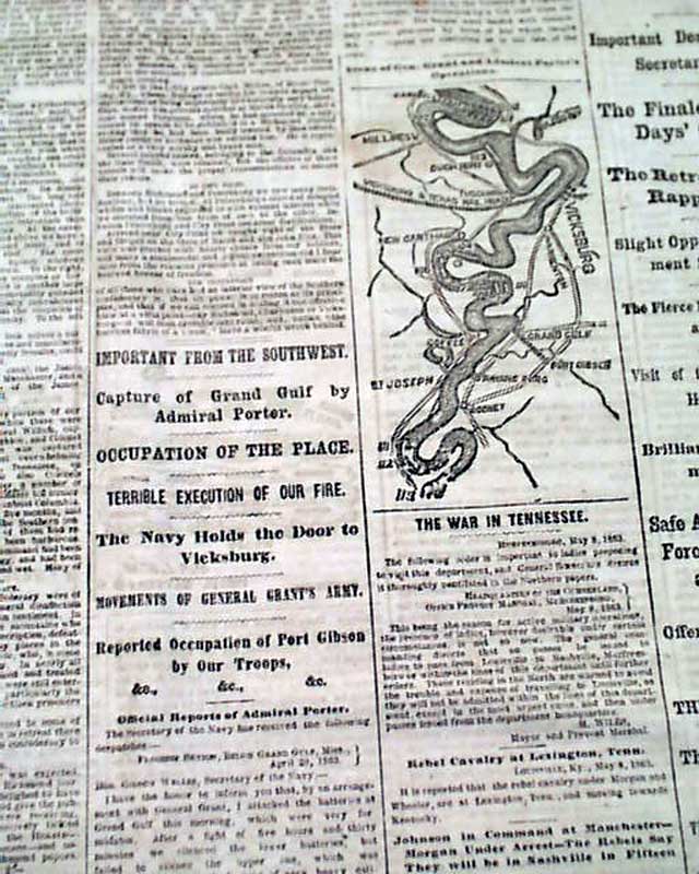
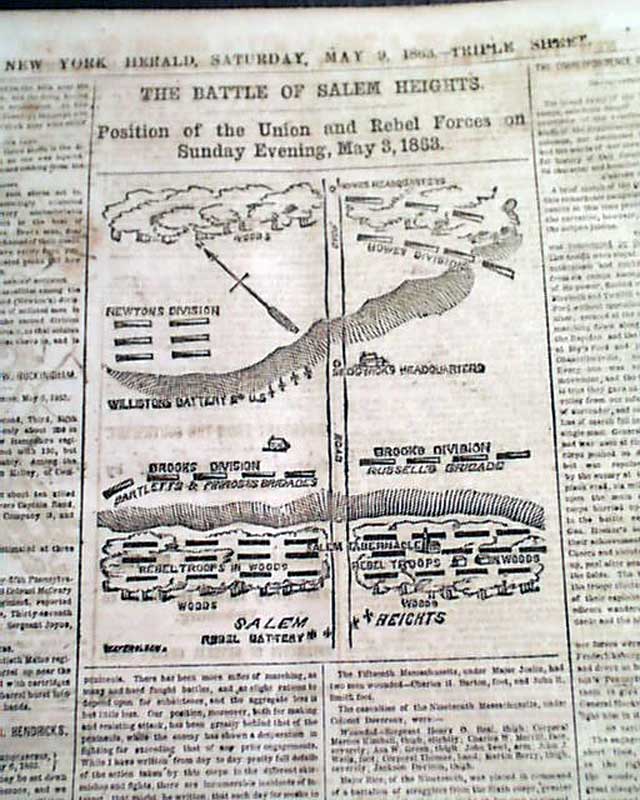
A smaller map is on page 3: "Scene of Gen. Grant and Admiral Porter's Operations" and yet another map on page 4: "THE BATTLE OF SALEM HEIGHTS".
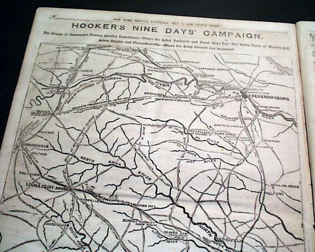
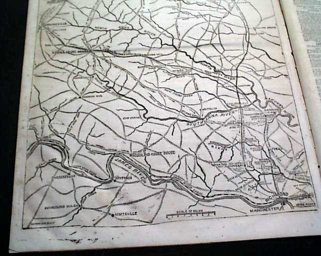
And perhaps the prime content is the huge, full page Civil War map on page 10: "HOOKER'S NINE DAYS' CAMPAIGN". Very unusual to have four Civil War maps in one issue.
A wealth of column heads on the Civil War as shown in the photos.
Twelve pages, irregular at the spine from disbinding, good condition.
* New York Harbor defenses
* Battle of Chancellorsville - Virginia
* Four American Civil War maps
The front page features a nice & very detailed Civil War map headed: "DEFENSE OF NEW YORK HARBOR" which shows Sandy Hook, Brooklyn, Coney Island, Staten Island and more.
A smaller map is on page 3: "Scene of Gen. Grant and Admiral Porter's Operations" and yet another map on page 4: "THE BATTLE OF SALEM HEIGHTS".
And perhaps the prime content is the huge, full page Civil War map on page 10: "HOOKER'S NINE DAYS' CAMPAIGN". Very unusual to have four Civil War maps in one issue.
A wealth of column heads on the Civil War as shown in the photos.
Twelve pages, irregular at the spine from disbinding, good condition.
Category: The Civil War
