
Map Of Veracruz & the castle of San Juan...
Item # 216770Sorry, but this item is no longer available. Please be in touch at info@rarenewspapers.com if you would like to be placed on a want list or are interested in a potential alternate issue.
* Vera Cruz, Mexico - San Juan MAP
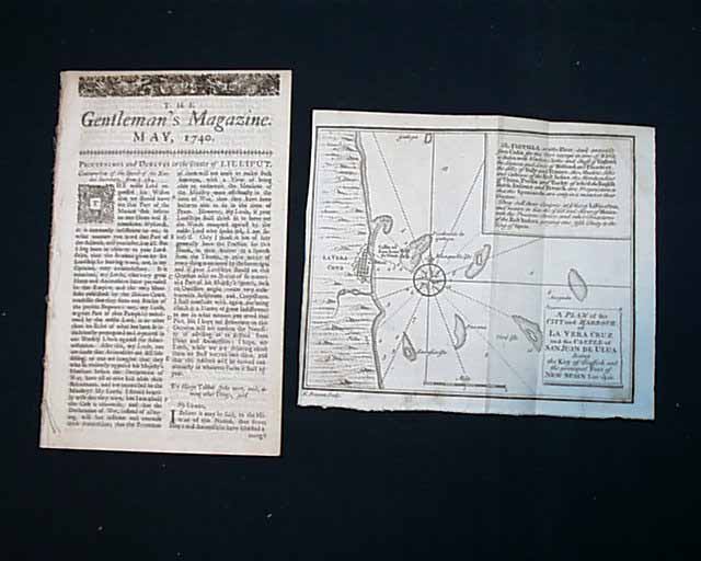
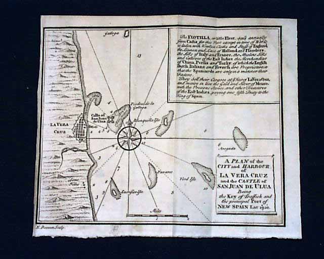
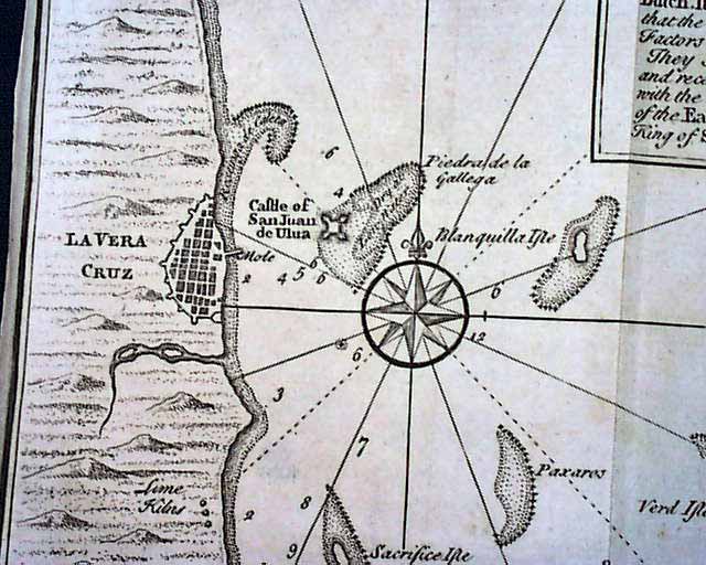
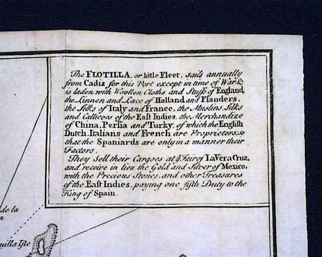
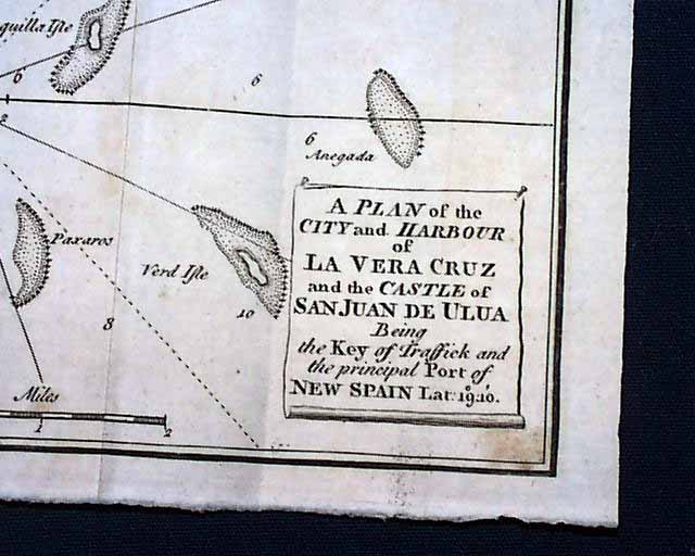
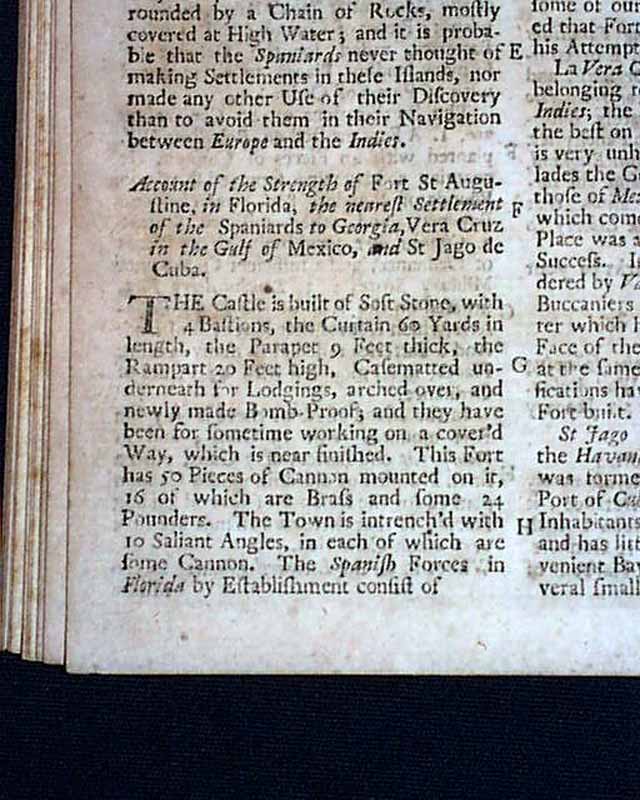
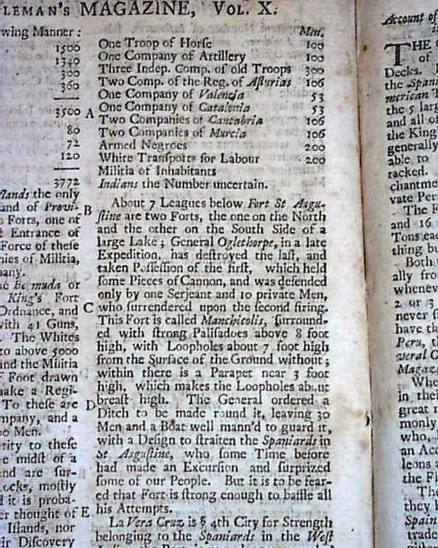
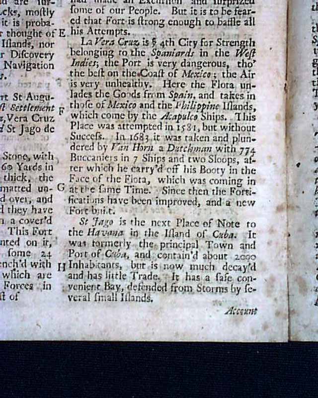
This was the very first publication to use the word "magazine" in the title. This successful publication enjoyed a long & well respected life having been published from 1731 through 1907. A feature of this issue is the nice foldout map of Vera Cruz, Castle of San Juan, Port of New Spain (see the photos). This map measures about 6 by 7 inches and is labeled: "A Plan of the City and Harbour of La Vera Cruz and the Castle of San Juan De Ulua being the Key of Traffick & the principal Port of New Spain." There is a related article within the magazine headed: "Account of the Strength of Fort St. Augustine in Florida, the Nearest Settlement of the Spaniards to Georgia, Vera Cruz, in the Gulf of Mexico, and St. Jago de Cuba." which mentions James Oglethorpe (see photos). We now spell this town as one word, Veracruz, which is on the Gulf of Mexico coast of Mexico. This issue contains a wide variety of other content including literary items, political affairs, news reports, various essays, and other tidbits.
Complete in 52 pages, measuring about 5 by 8 inches and in nice condition. This issue is lacking the full title index page typically found with issues of this title, but does have the half titlepg. (see photo).
The state of Veracruz de Ignacio de la Llave is one of the 31 states that compose Mexico (does not include the Mexican Federal District).
It is located in the east central part of the country, between 1710' and 2238' North and between 9355' and 9838' West. It has a mainland area of 72,815km and includes several islands in the Gulf of Mexico totalling another 58 km.
Veracruz borders the states of Tamaulipas to the north, Oaxaca and Chiapas to the south, Tabasco to the southeast, Puebla, Hidalgo, and San Luis Potosi to the west, and the Gulf of Mexico to the east.
Its capital is Xalapa, located in the northern part of the state. With more than 7 million inhabitants, the state of Veracruz is the third most populous in the nation, after the Federal District and the state of Mxico.
On the coastal plains and throughout most of the state, the climate is hot and humid. On the foothills of the mountains, the climate is cool and humid. The climate only becomes cold in the mountain regions, where it also rains copiously. Veracruz is occasionally affected by hurricanes from June to October.
Its formal name is Veracruz de Ignacio de la Llave in honor of General Ignacio de la Llave, who died in 1863 after wounds received during the French invasion of Mexico. The official title of this Mexican state was Veracruz-Llave from 1863 to 2004.
In 1865, rather than surrendering to American forces, Major General Sterling Price of the Confederate States of America, Missouri's highest ranking military officer led his army to Mexico where he became leader of a colony of Confederate exiles at Carlota in the state of Veracruz.
On January 1, 2007, a combined band of high school children from Xalapa, Veracruz were given the honor of representing Mexico in the Rose Parade as one of the many marching bands. Banda Delfines played and sang the easily recognized La Bamba dressed in traditional white Guayabera, white Pants, red handkerchief, white sombrero and white boots that the song is performed to.
Category: The 1600's and 1700's
