Home > Back to Search Results >
Very rare 1836 map of Texas...

Very rare 1836 map of Texas...
Item # 701517
Currently Unavailable. Contact us if you would like to be placed on a want list or to be notified if a similar item is available.
August 14, 1836
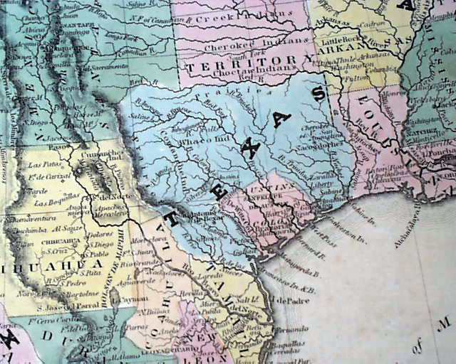
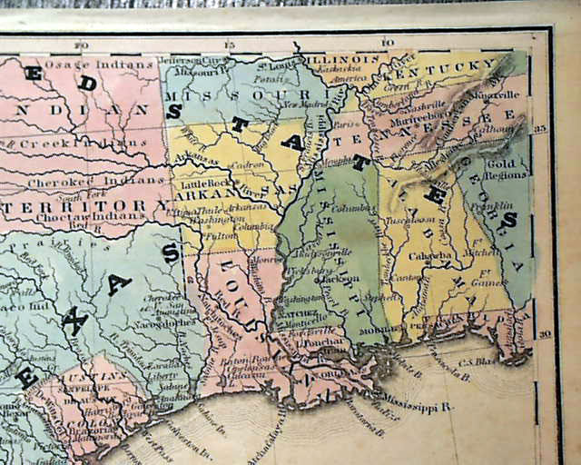
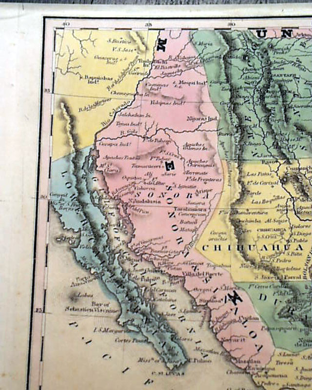
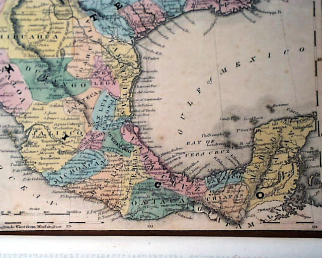
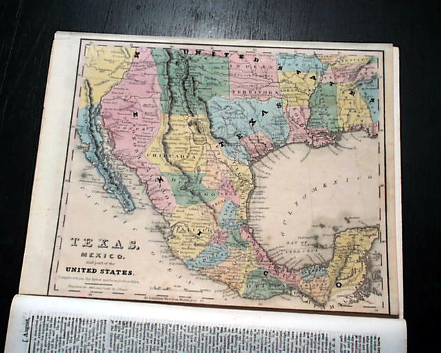
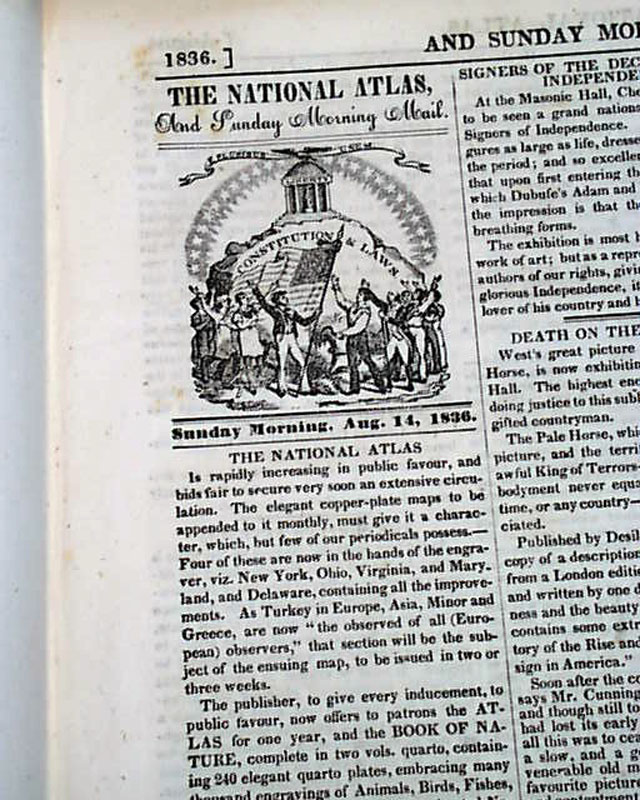
THE NATIONAL ATLAS & SUNDAY MORNING MAIL, Philadelphia, Aug. 14, 1836 This was a weekly newspaper that included, on a monthly basis, a copper-plate, color map. This being the volume 1, number 3 issue, it is likely this map was the first.
The map is titled: "TEXAS, Mexico, and part of the United States, Compiled from the latest and best Authorities".
This was a critical year for Texas, the year in which it achieved its independence from Mexico with the Battle of San Jacinto. Notice the boundaries of Texas at the time being much different from today.
Political divisions are shown as hand-colored blocks. The Rocky Mountains are a narrow ridge, and Oklahoma and Kansas are labeled "Indian Territory." Austin's Colony is separate from Texas. The bottom border of the map is mostly trimmed off but otherwise no loss of type or map area. Nice condition.
Sixteen pages, 9 by 11 1/4 inches (as is the map), very nice condition.
Sixteen pages, 9 by 11 1/4 inches (as is the map), very nice condition.
Category: Pre-Civil War
No Longer Available