Home > Back to Search Results >
Huge map of the Mississippi River dated June 1, 1775...
Huge map of the Mississippi River dated June 1, 1775...
Item # 700671
January 01, 1783
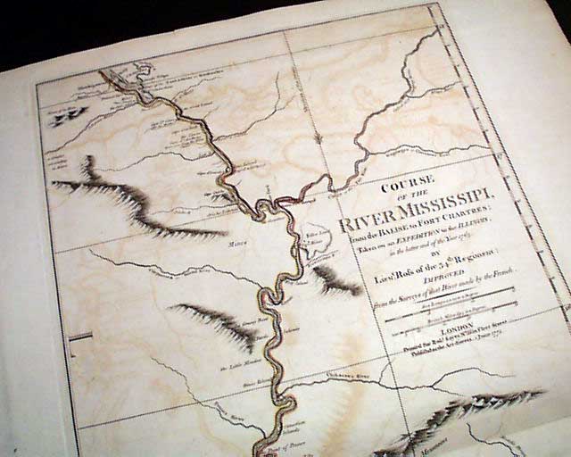
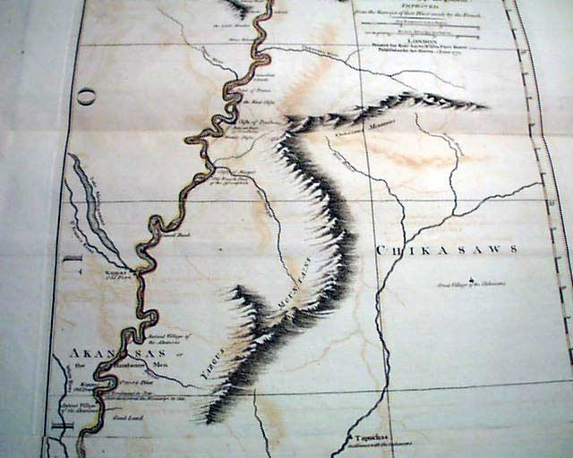
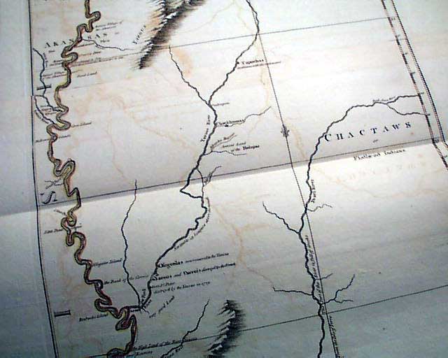
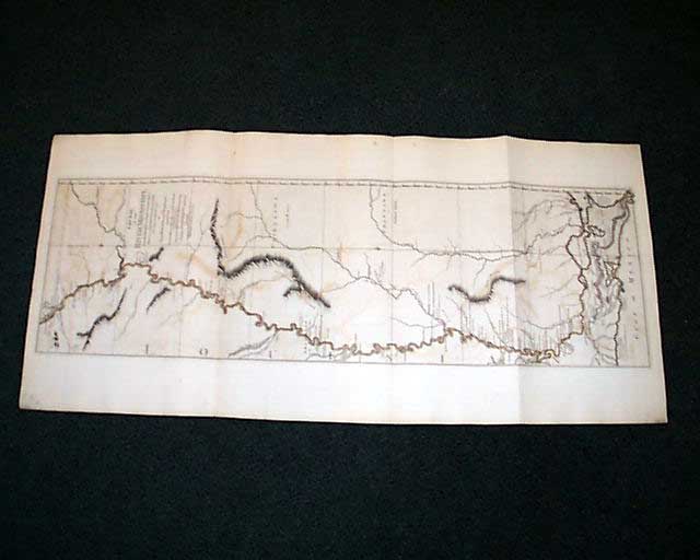
COURSE of the RIVER MISSISSIPI [sic] from the Balise to Fort Chartres; Taken on an Expedition to the Illinois, in the latter end of the Year 1763 by Lieut. Ross of the 34th Regiment: Improved from the Surveys of that River made by the French".
London, Printed for Robt. Sayer No. 53 in 'Fleet Street, Published as the Act directs, 11 June 1775"
A noted map dealer describes this piece as: "The Most Influential Map of the Mississippi River on the eve of the American Revolutionary War."
London, Printed for Robt. Sayer No. 53 in 'Fleet Street, Published as the Act directs, 11 June 1775"
A noted map dealer describes this piece as: "The Most Influential Map of the Mississippi River on the eve of the American Revolutionary War."
He offers further research into its significance: "A highly detailed map of the Mississippi River, from just north of the confluence of the Ohio River to the Gulf of Mexico, published by Thomas Jefferys in London.
Lieutenant Ross' large scale map of the Mississippi River is of the few large-format maps of the Mississippi published during the 18th century. Ross' map was the first official English survey of the Lower Mississippi, and one of the most historically significant American maps, delineating the British territorial gains following the French and Indian War and later establishing the future western boundary of the new United States. The map opened the area to settlement from the east and defined the western limits of the American colonies. It would also be an area of great intrigue in the years immediately following the publication of this map, as France and Spain both evaluated the prospects of extending and preserving their territorial claims in the region prior to the Louisiana Purchase.
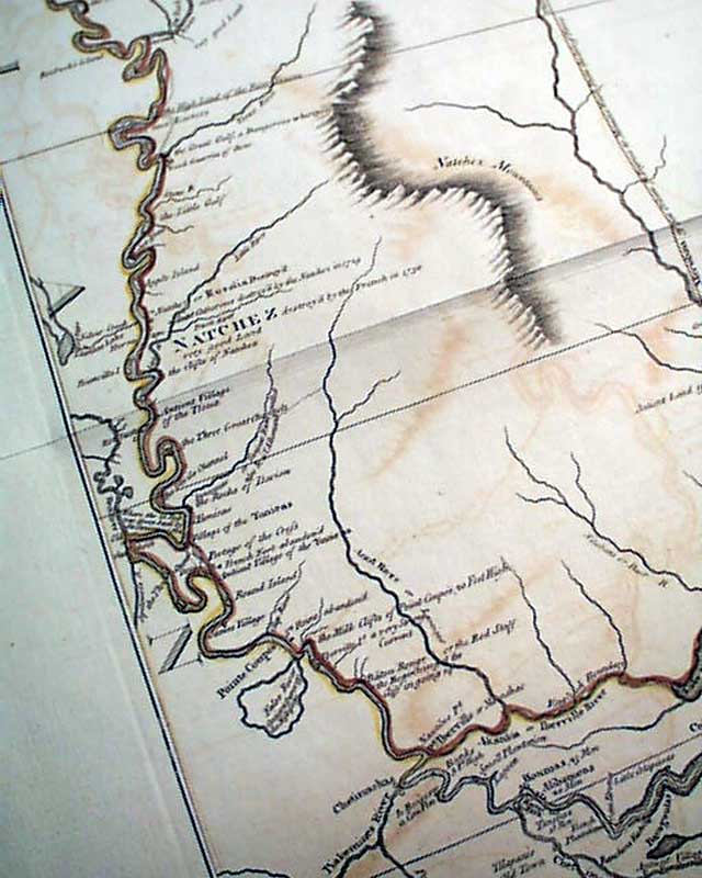
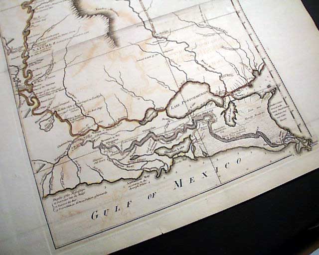
Ross's map provides a large-scale depiction of the river and its topographical features, such as islands in the river, navigational instructions, other rivers and connecting tributaries, boundaries, towns and settlements, forts, local history (including the spot where De Soto discovered the Mississippi in 1541), quarries and potential mining areas, productive land, cane fields, and mountains and other topographical details. A number of Indian Tribes are shown, including the Flathead, Chactaw, Chikasaw, Chackhuma, "Akansas or the Handsome Men," Wyapes, Corrois, Yazous, Ofogoulas, Chepoussa, Caskaskias, Colapissas (later known as Huoma), and others. Frederick Webb Hodge (Handbook of American Indians North of Mexico) makes numerous citations to this map.
Following the Treaty of Paris in 1763 ending the French & Indian War, a British expedition was sent to the Illinois territory to demand the surrender of Fort de Chartres, the last outpost under French control in the area. Lieutenant John Ross, surveyor of the 34th Regiment of the British Army, went with this expedition and surveyed the lower part of the River, below Fort Chartres, to the mouth of the Mississippi River. While Ross was able to provide a good account of the Eastern Bank of the River, he was not able to land on the west bank, which was then claimed by Spain.
A nice example of this seminal collector's map of the Mississippi River.
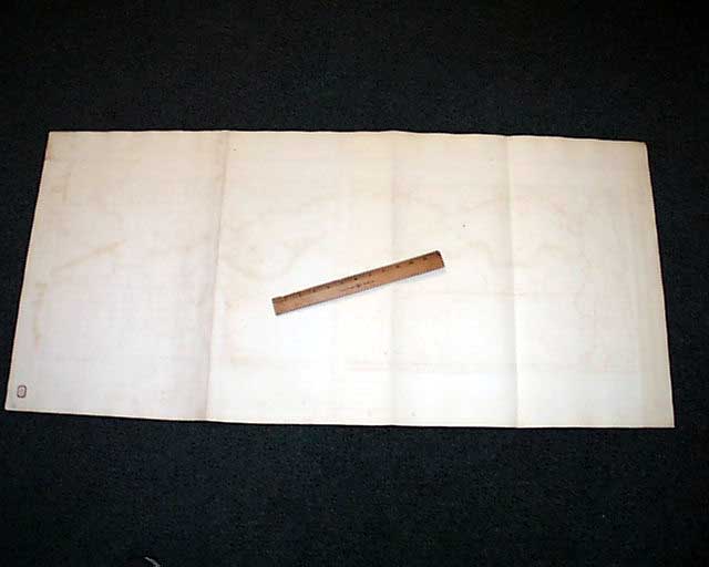
Measures 46 by 21 1/2 inches including the wide margins, printed on heavy laid paper, the course of the river is hand-colored. Blank on he reverse, a few very tiny margin tears. A very handsome map in very nice condition.
Measures 46 by 21 1/2 inches including the wide margins, printed on heavy laid paper, the course of the river is hand-colored. Blank on he reverse, a few very tiny margin tears. A very handsome map in very nice condition.
Category: The 1600's and 1700's