Home > Back to Search Results >
George Washington at age 22... Great map of America...
George Washington at age 22... Great map of America...
Item # 694072
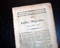
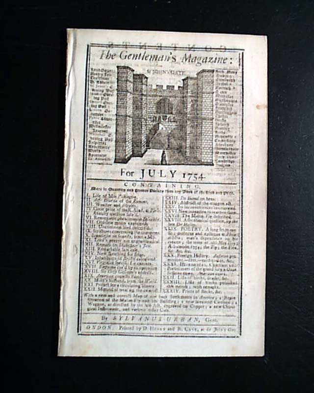
THE GENTLEMAN'S MAGAZINE, London, England, July, 1754
* Great American colonies mid-18th century map
* Future general & president George Washington
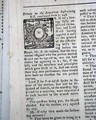
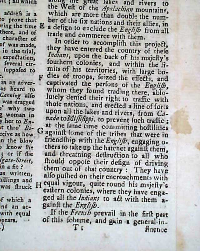
Inside has the continuation of an Account of the Encroachments made by the French on the British Settlements in America. In the account are the various measures taken by the British to prevent the encroachments, including an expedition led by George Washington, who is mentioned three times in this report. He was just 22 years old at the time!
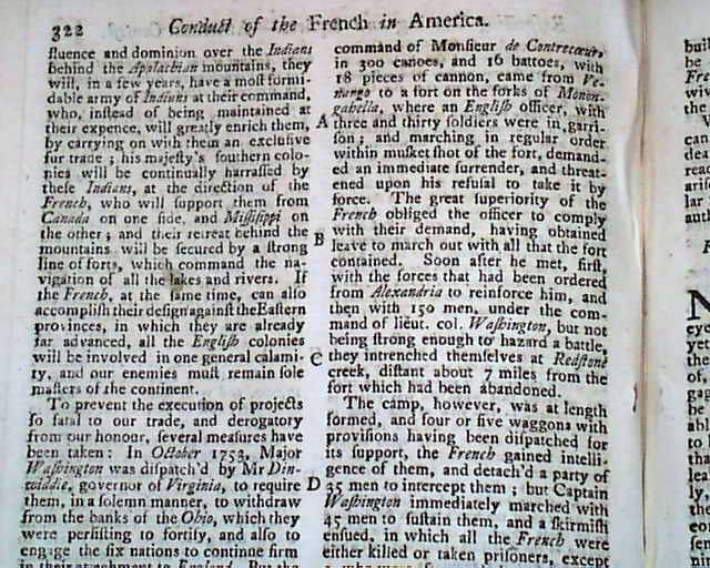
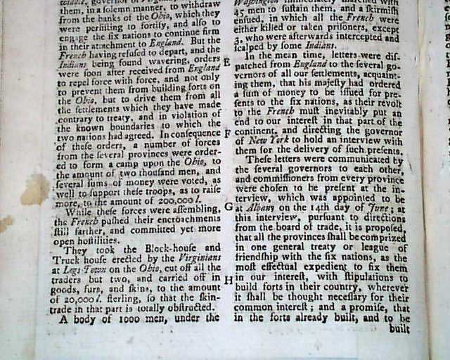
The first reference to Washington states that in October of 1753, he was dispatched by Governor Dinwiddie of Virginia to require the French: "...in a solemn manner, to withdraw from the banks of the Ohio, which they were persisting to fortify...". The account continues and states that the French refused, and orders were received from England to use force to extricate the French. As a result, forces from several provinces: "...were ordered to form a camp upon the Ohio... While the forces gathered, the French ...pushed their encroachments still farther, and committed yet more open hostilities... " with more.
The account later states that French forced a surrender at a fort and the officer and his men marched out. This group eventually met reinforcements: "...and then with 150 men, under the command of lieut. col. Washington...they entrenched themselves at Redstone creek...". A camp was formed and: "...five wagons of provisions were dispatched for its support, the french gained intelligence of them and detach'd a party of 35 men to intercept them; but Captain [sic] Washington immediately marched with 45 men to sustain them & a skirmish ensued in which all the French were either killed or taken prisoners..." & more. A fine account, and early for Washington who is mentioned three times.
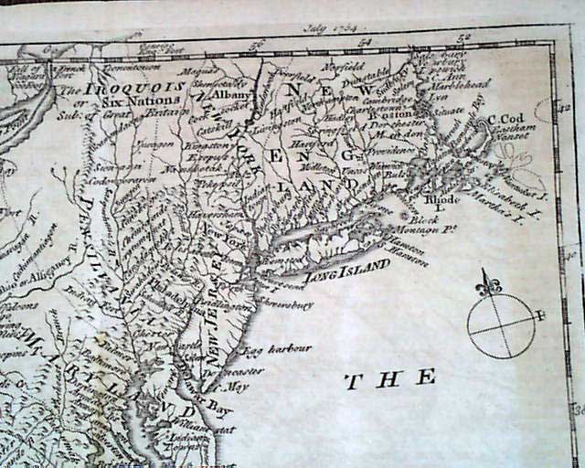
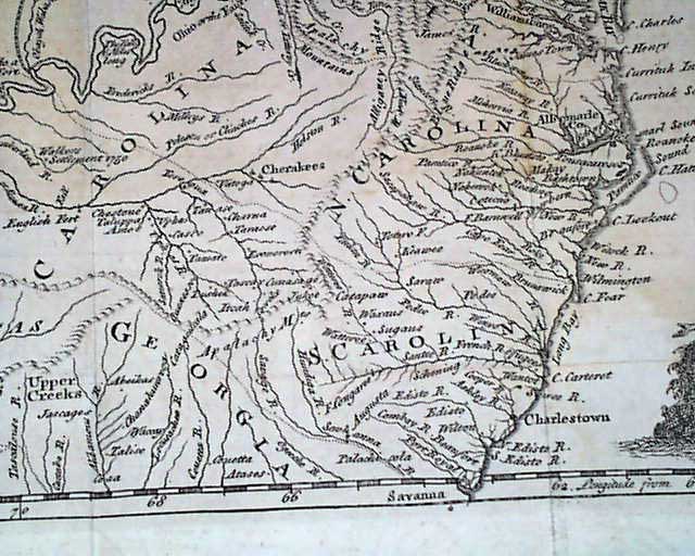
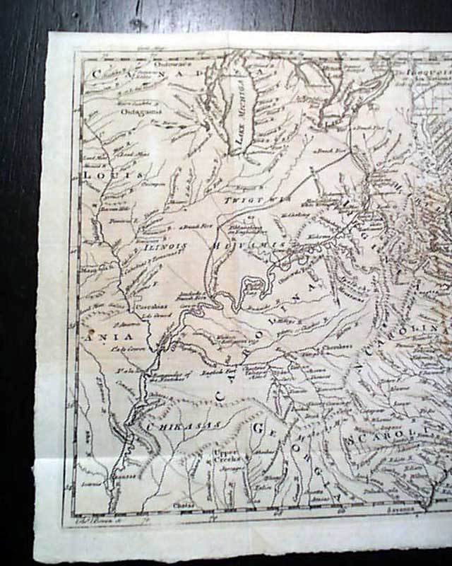
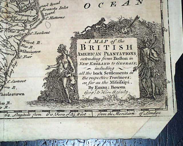
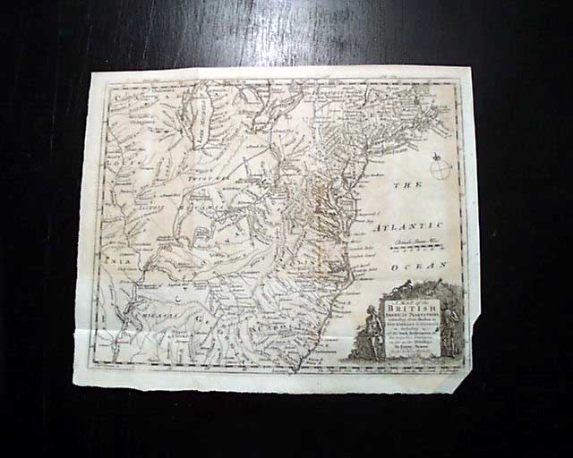
As if this was not sufficient for one issue, this magazine still contains the foldout map titled within the decorative cartouche: "A Map of the BRITISH American Plantations, extending from Boston in New England to Georgia: including all the back Settlements in the respective Provinces, as far as the Mississippi...".
This map folds out to 9 1/2 by 11 3/4 inches, a trim to the lower right corner is close to the border (see photos). In very nice condition. It is extremely detailed and also includes those portions in the "West" of America including Illinois, the Louisiana Territory, the land west of Lake Michigan, parts of Arkansas, and more.
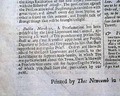
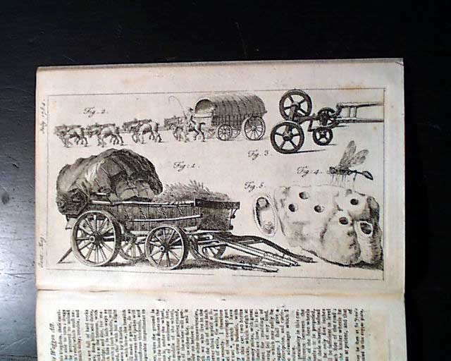
This issue also still includes the other foldout plate called for which includes "A new invented carriage...".
Complete in 56 pages, 5 by 8 1/4 inches, tiny binding holes at the blank spine margin, full title/contents page with an engraving of St. John's Gate, great condition.
* Great American colonies mid-18th century map
* Future general & president George Washington
Inside has the continuation of an Account of the Encroachments made by the French on the British Settlements in America. In the account are the various measures taken by the British to prevent the encroachments, including an expedition led by George Washington, who is mentioned three times in this report. He was just 22 years old at the time!
The first reference to Washington states that in October of 1753, he was dispatched by Governor Dinwiddie of Virginia to require the French: "...in a solemn manner, to withdraw from the banks of the Ohio, which they were persisting to fortify...". The account continues and states that the French refused, and orders were received from England to use force to extricate the French. As a result, forces from several provinces: "...were ordered to form a camp upon the Ohio... While the forces gathered, the French ...pushed their encroachments still farther, and committed yet more open hostilities... " with more.
The account later states that French forced a surrender at a fort and the officer and his men marched out. This group eventually met reinforcements: "...and then with 150 men, under the command of lieut. col. Washington...they entrenched themselves at Redstone creek...". A camp was formed and: "...five wagons of provisions were dispatched for its support, the french gained intelligence of them and detach'd a party of 35 men to intercept them; but Captain [sic] Washington immediately marched with 45 men to sustain them & a skirmish ensued in which all the French were either killed or taken prisoners..." & more. A fine account, and early for Washington who is mentioned three times.
As if this was not sufficient for one issue, this magazine still contains the foldout map titled within the decorative cartouche: "A Map of the BRITISH American Plantations, extending from Boston in New England to Georgia: including all the back Settlements in the respective Provinces, as far as the Mississippi...".
This map folds out to 9 1/2 by 11 3/4 inches, a trim to the lower right corner is close to the border (see photos). In very nice condition. It is extremely detailed and also includes those portions in the "West" of America including Illinois, the Louisiana Territory, the land west of Lake Michigan, parts of Arkansas, and more.
This issue also still includes the other foldout plate called for which includes "A new invented carriage...".
Complete in 56 pages, 5 by 8 1/4 inches, tiny binding holes at the blank spine margin, full title/contents page with an engraving of St. John's Gate, great condition.
Category: The 1600's and 1700's