
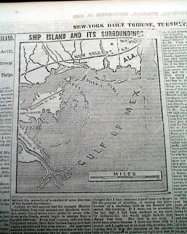
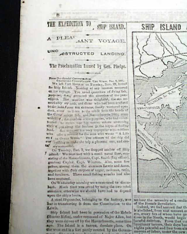
Map showing Ship Island during the Civil War...
Item # 695264
·
NEW YORK TRIBUNE, Dec. 17, 1861 The format of this title at this time was advertisements on the front page with the wealth of Civil War reporting on inside pages.
The back page features a Civil War map headed: "SHIP ISLAND AND ITS SURROUNDINGS". Column heads include: "THE EXPEDITION TO SHIP ISLAND" "Unobstructed Landing" "Slavery in the District of Columbia" "Interesting From Port Royal" "The Expedition To Beaufort" "A Negro Battle" and much more.
Eight pages, never-trimmed margins, minimal margin wear, nice condition.
Background: The December 17, 1861, issue of the New York Tribune captures a transformative hinge point in the American Civil War, documenting the Union's shift from disorganized skirmishing to a sophisticated, multi-front naval and social strategy. The "Unobstructed Landing" at Ship Island was militarily vital, as it established the essential deep-water staging ground for Admiral David Farragut’s future capture of New Orleans, effectively beginning the strangulation of Confederate commerce in the Gulf. Simultaneously, the reports from Port Royal and Beaufort signify a profound social shift; as Union forces occupied the South Carolina Sea Islands, the "Port Royal Experiment" began, marking one of the first instances where the federal government had to address the status of "contraband" (formerly enslaved) people through labor and education. By highlighting "Slavery in the District of Columbia" alongside these military maneuvers, the Tribune—under Horace Greeley’s radical editorial lens—framed the conflict not just as a war for territory, but as an accelerating legislative and moral crusade against the institution of slavery.
Category: Yankee
Price
$39
100% Authentic: Original printing, never a reproduction.
Other issues you may like
§ related
Map showing Ship Island during the Civil War...
NEW YORK TRIBUNE, Dec. 17, 1861 The format of this title at this time was advertisements on the front page with the wealth of Civil War reporting on inside...
Dec 1861
$42
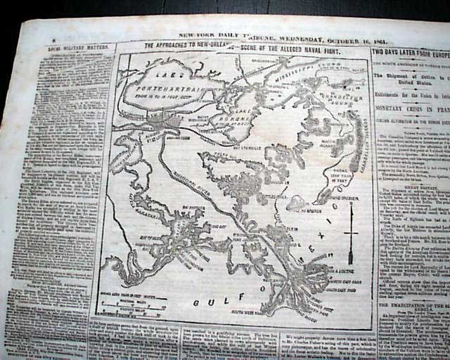
Map showing the approach to New Orleans...
NEW YORK TRIBUNE, Oct. 16, 1861
* Lower Mississippi River map
The format of this title at this time was advertisements on the front page with the...
* Lower Mississippi River map
The format of this title at this time was advertisements on the front page with the...
Oct 1861
$34
Two front page Civil War maps...
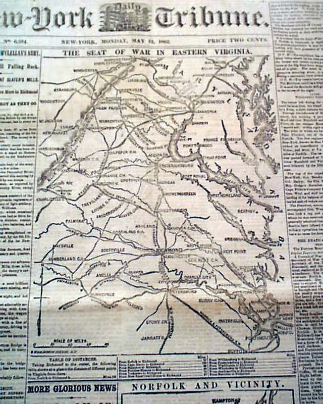
NEW YORK TRIBUNE, May 12, 1862
* Battle of Eltham's Landing
* Surrender of Norfolk, Virgina
* Two ftpg. Civil War maps
The front page is dominated by not one...
* Battle of Eltham's Landing
* Surrender of Norfolk, Virgina
* Two ftpg. Civil War maps
The front page is dominated by not one...
May 1862
$47
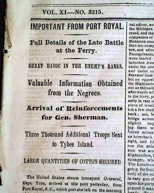
The latest Civil War reports...
NEW YORK TIMES, Jan. 11, 1862 Among the ftpg. column heads on the Civil War are: "Important From Port Royal" "Full Details of the Late Battle at the Ferry"...
Jan 1862
$27