


Huge Civil War map of the Richmond vicinity...
Item # 603245Sorry, but this item is no longer available. Please be in touch at info@rarenewspapers.com if you would like to be placed on a want list or are interested in a potential alternate issue.
May 24, 1862
THE PHILADELPHIA INQUIRER, May 24, 1862
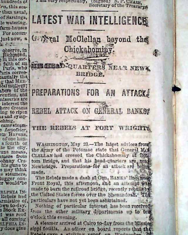
* Battle of Drewry's Bluff
* Fort Darling attack
* Huge map for display
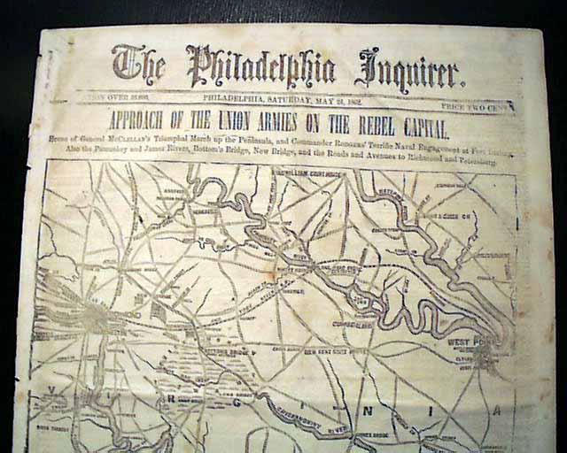
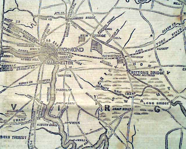
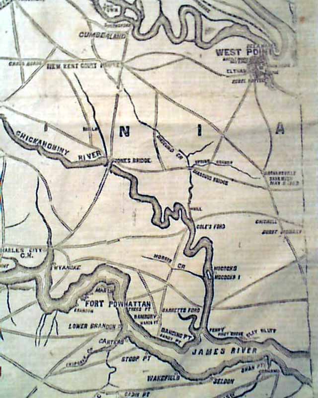
As seen in the photos, this issue is dominated by the great & huge Civil War map on the front page, headed: "APPROACH OF THE UNION ARMIES ON THE REBEL CAPITAL--Scene of General McClellan's Triumphal March up the Peninsula, & Commander Rodgers' Terrific Naval Engagement at Fort Darling. Also the Pamunkey & James Rivers, Bottom's Bridge, New Bridge, and the Roads & Avenues to Richmond & Petersburg." The map shows much detail of the vicinity.
Eight pages, nice condition.
* Battle of Drewry's Bluff
* Fort Darling attack
* Huge map for display
As seen in the photos, this issue is dominated by the great & huge Civil War map on the front page, headed: "APPROACH OF THE UNION ARMIES ON THE REBEL CAPITAL--Scene of General McClellan's Triumphal March up the Peninsula, & Commander Rodgers' Terrific Naval Engagement at Fort Darling. Also the Pamunkey & James Rivers, Bottom's Bridge, New Bridge, and the Roads & Avenues to Richmond & Petersburg." The map shows much detail of the vicinity.
Eight pages, nice condition.
Category: Yankee
