

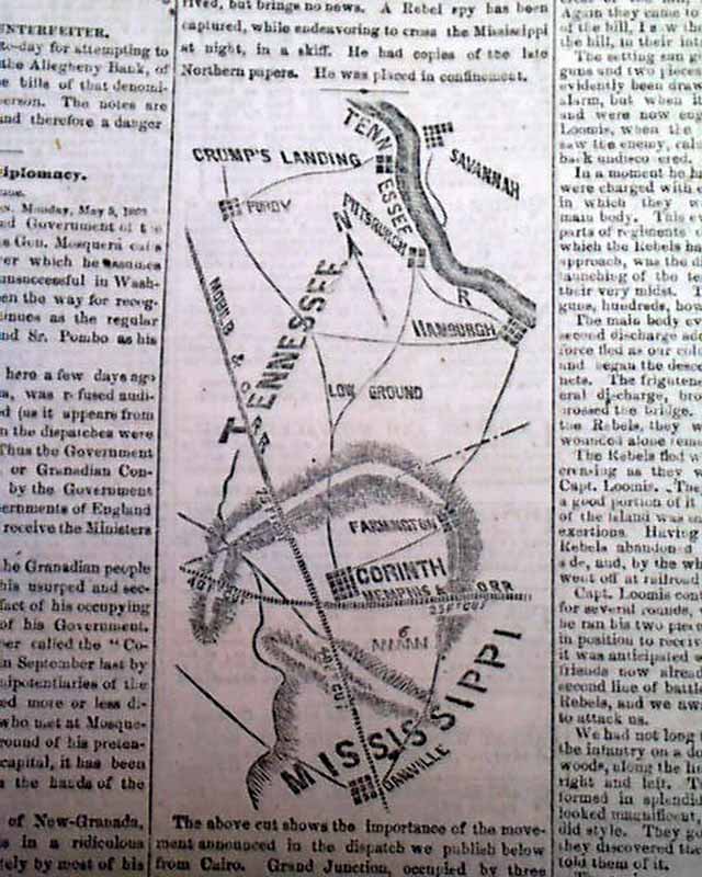
Civil War map of the Yorktown vicinity...
Item # 594601
·
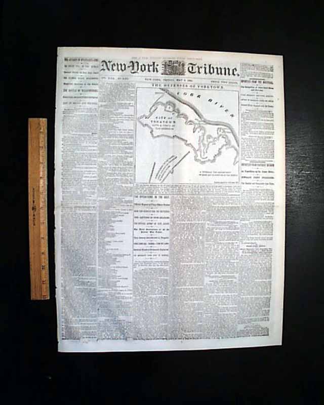
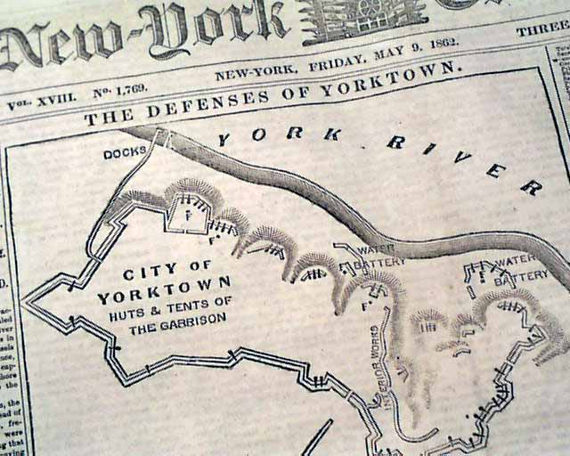
NEW YORK TRIBUNE, May 9, 1862
* Siege of Yorktown ends
* Battle of Williamsburg, Virginia
* New Orleans LA Louisiana
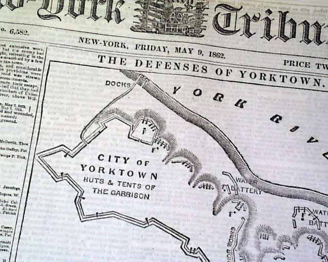
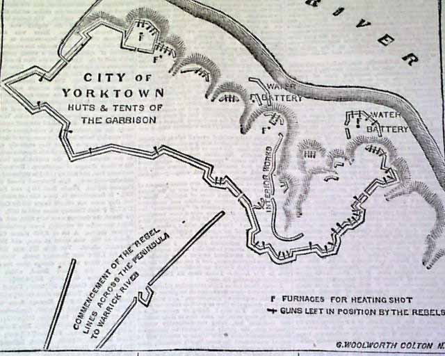
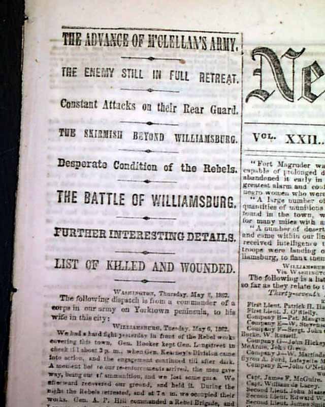
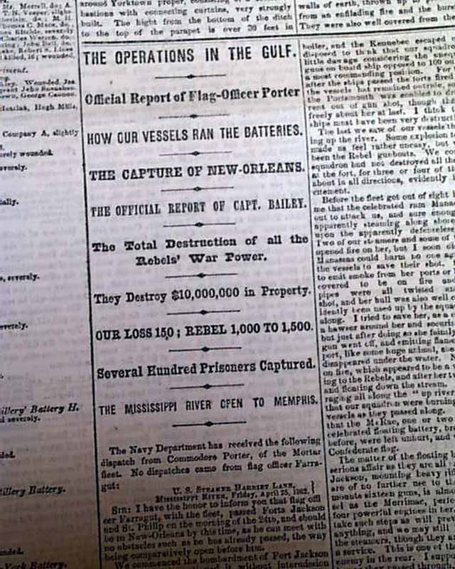
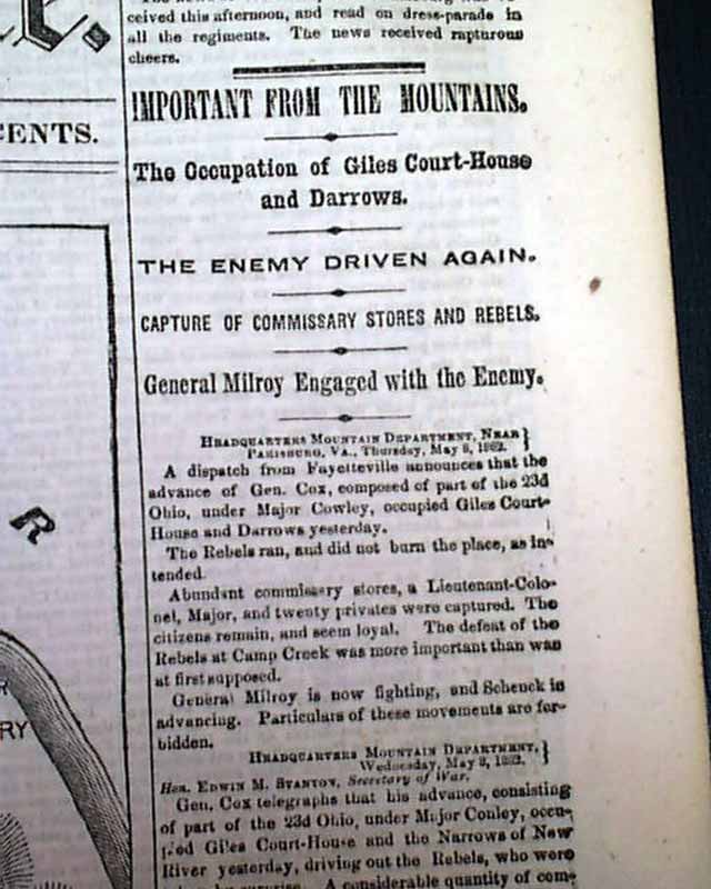
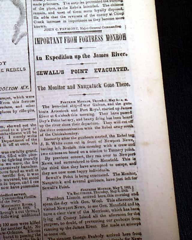
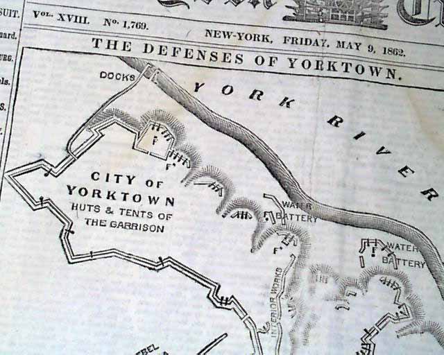
The front page is dominated by a nice Civil War map headed: "The Defenses Of Yorktown" (see photos). There are nice one column heads also: "The Advance of McClellan's Army", "The Enemy Still In Full Retreat", "The Battle of Williamsburg", "The Operations In The Gulf", "The Capture of New Orleans", "Sewall's Point Evacuated", "The Occupation of Giles Court-House & Darrows" and more.
Complete in 12 pages, great condition.
* Siege of Yorktown ends
* Battle of Williamsburg, Virginia
* New Orleans LA Louisiana
The front page is dominated by a nice Civil War map headed: "The Defenses Of Yorktown" (see photos). There are nice one column heads also: "The Advance of McClellan's Army", "The Enemy Still In Full Retreat", "The Battle of Williamsburg", "The Operations In The Gulf", "The Capture of New Orleans", "Sewall's Point Evacuated", "The Occupation of Giles Court-House & Darrows" and more.
Complete in 12 pages, great condition.
Category: Yankee
Price
$50
100% Authentic: Original printing, never a reproduction.
Other issues you may like
§ related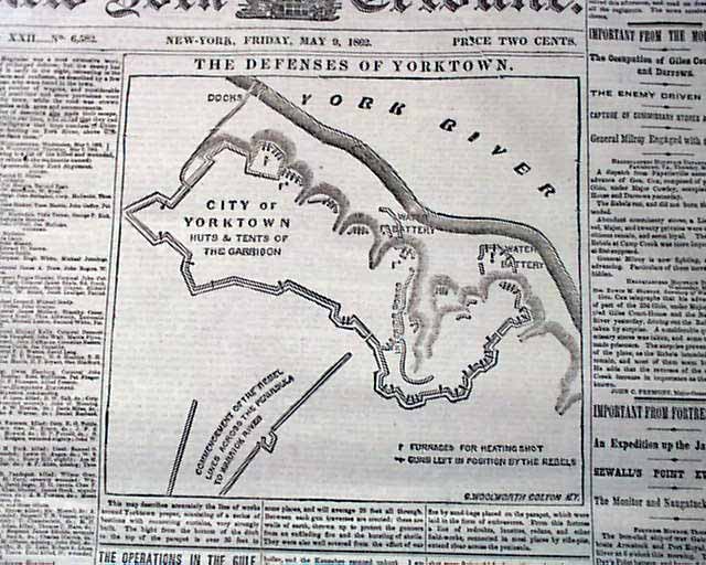
Civil War map of the Yorktown vicinity...
NEW YORK TRIBUNE, May 9, 1862
* Siege of Yorktown ends
* Battle of Williamsburg, Virginia
* New Orleans LA Louisiana
The front page is dominated by...
* Siege of Yorktown ends
* Battle of Williamsburg, Virginia
* New Orleans LA Louisiana
The front page is dominated by...
May 1862
$52
Two Civil War maps...
NEW YORK SEMI-WEEKLY TRIBUNE, New York, May 9, 1862
* Yorktown, Virginia Map
* New Orleans, Louisiana
* Battle of Williamsburg
The ftpg. features a...
* Yorktown, Virginia Map
* New Orleans, Louisiana
* Battle of Williamsburg
The ftpg. features a...
May 1862
$46
Two Civil War maps...
NEW YORK SEMI-WEEKLY TRIBUNE, New York, May 9, 1862 The ftpg. features a nice Civil War map headed: "The Defences Of Yorktown" which shows a close-up view...
May 1862
$52
Great Civil War map of Yorktown & Norfolk & vicinity...
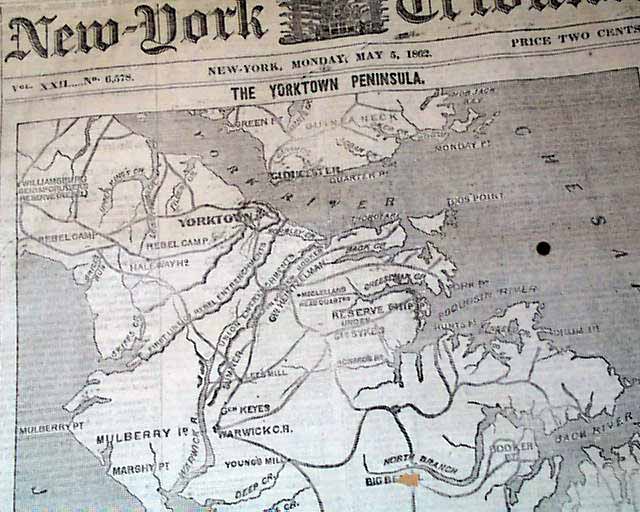
NEW YORK TRIBUNE, May 5, 1862
* George B. McClellan's Peninsula Campaign map
* Siege & capture of Yorktown & Gloucester Point
The front page is dominated by...
* George B. McClellan's Peninsula Campaign map
* Siege & capture of Yorktown & Gloucester Point
The front page is dominated by...
May 1862
$55