
Early map of Germany... Early map of France...
Item # 565629Sorry, but this item is no longer available. Please be in touch at info@rarenewspapers.com if you would like to be placed on a want list or are interested in a potential alternate issue.
GENTLEMAN'S MAGAZINE, London, December, 1758
* Early map of Germany... Early map of France...
A very nice magazine from during the French & Indian War from the "mother country" with a wide range of varied content including news of the day, political reports, literary items, and other unusual tidbits. This was the first periodical to use the word "magazine" in its title, having begun in 1731 and lasting until 1907.
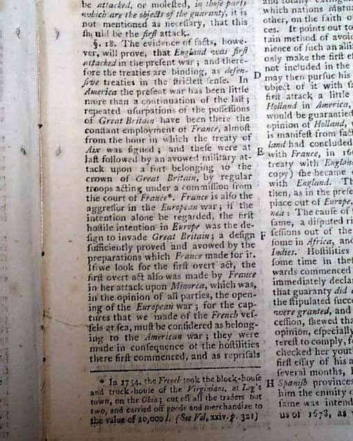
One article: "Claims of the Dutch Further Stated" includes some reports concerning the situation in America, a portion noting: "...In America the present war has been little more than a continuation of the last..." (see).
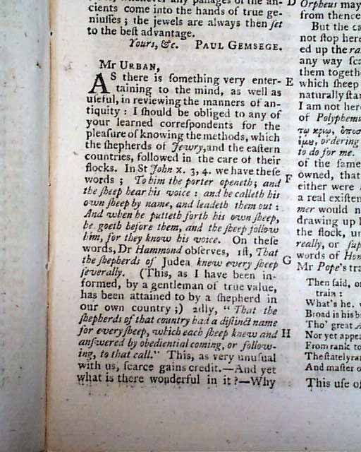
"Antient Custom of Shepherds" considers Jewish shepherds (see for portions).
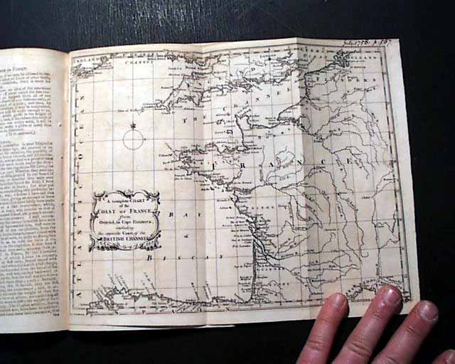
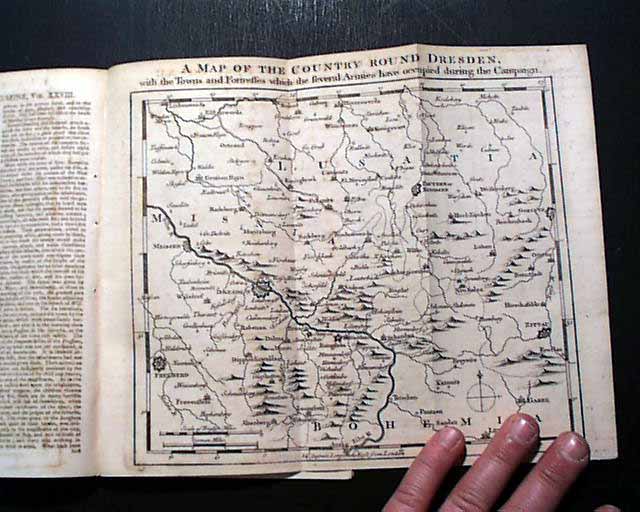
But the prime features of this issue would be the two very nice foldout maps, one titled: "A Map of the Country Round Dresden, with the Towns & Fortresses which the Several Armies have occupied during the Campaign." in present-day Germany (see) which shows much detail. This map measures 8 1/2 by 10 1/4 inches & is in great condition. The other map is: "A Complete Chart of the Coast of France..." of the same size as the other (see).
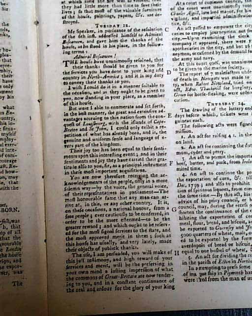
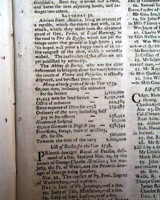
Near the back is the "Historical Chronicle" which has various news events of the day. Included is a report noting: "Advices from America bring an account of a repulse, which the enemy met with, in an attack which they made upon the advanced guard of Gen. Forbes at Loyal Hanning, in the road to Fort du Quesne...happy omen of an entire conquest of the place, which is earnestly wished..." with just a bit more (see).
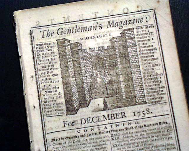
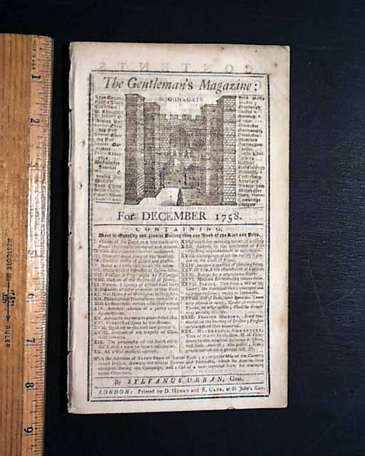
Complete in 46 pages, measures 5 by 8 1/2 inches with a full title/index page which includes an engraving of St. John's Gate. Very nice, clean condition.
* Early map of Germany... Early map of France...
A very nice magazine from during the French & Indian War from the "mother country" with a wide range of varied content including news of the day, political reports, literary items, and other unusual tidbits. This was the first periodical to use the word "magazine" in its title, having begun in 1731 and lasting until 1907.
One article: "Claims of the Dutch Further Stated" includes some reports concerning the situation in America, a portion noting: "...In America the present war has been little more than a continuation of the last..." (see).
"Antient Custom of Shepherds" considers Jewish shepherds (see for portions).
But the prime features of this issue would be the two very nice foldout maps, one titled: "A Map of the Country Round Dresden, with the Towns & Fortresses which the Several Armies have occupied during the Campaign." in present-day Germany (see) which shows much detail. This map measures 8 1/2 by 10 1/4 inches & is in great condition. The other map is: "A Complete Chart of the Coast of France..." of the same size as the other (see).
Near the back is the "Historical Chronicle" which has various news events of the day. Included is a report noting: "Advices from America bring an account of a repulse, which the enemy met with, in an attack which they made upon the advanced guard of Gen. Forbes at Loyal Hanning, in the road to Fort du Quesne...happy omen of an entire conquest of the place, which is earnestly wished..." with just a bit more (see).
Complete in 46 pages, measures 5 by 8 1/2 inches with a full title/index page which includes an engraving of St. John's Gate. Very nice, clean condition.
Category: The 1600's and 1700's
