

Civil War map shows a portion of the Yazoo and Mississippi Rivers...
Item # 680262
·
NEW YORK HERALD, July 24, 1862
* CSS Arkansas - Confederate ironclad warship
* Mississippi & Yazoo Rivers
* Greenville Missouri MO
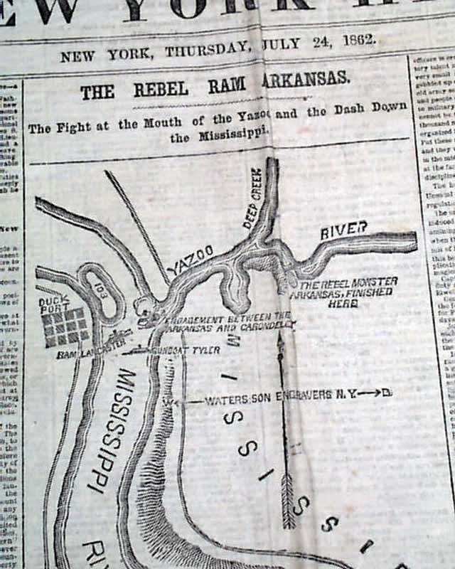
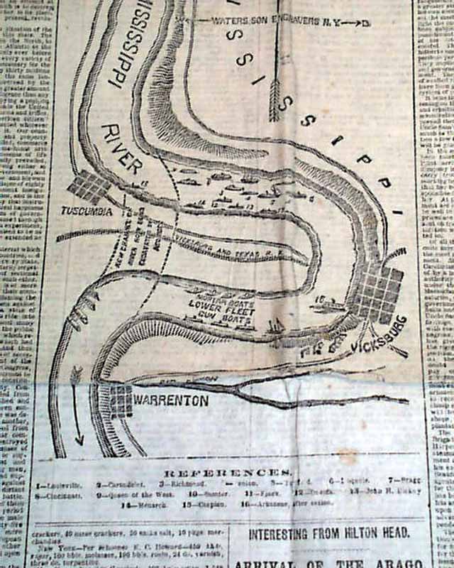
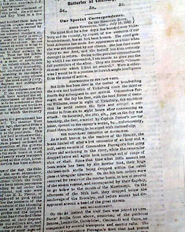
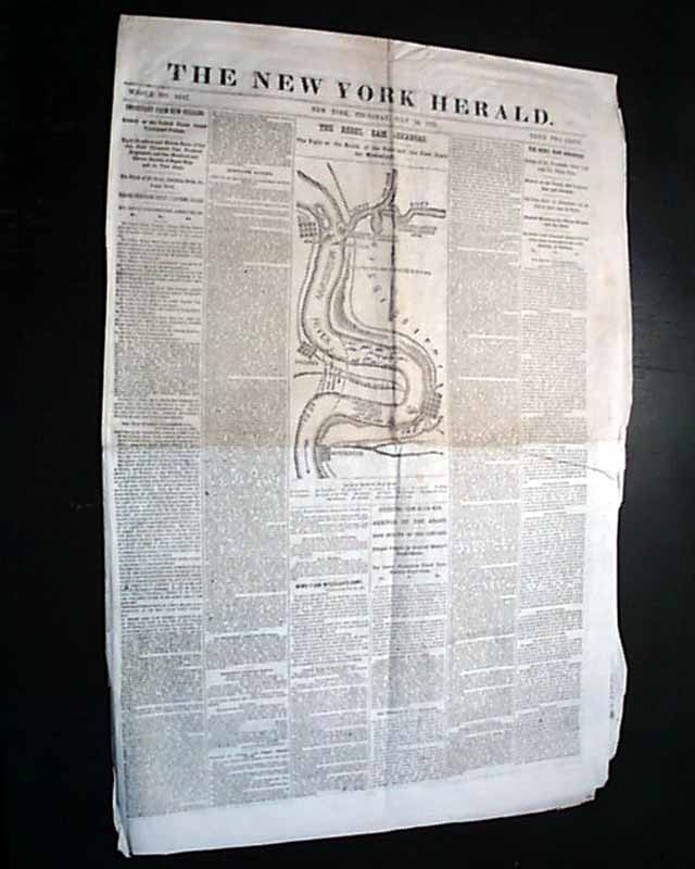
The front page creates a Civil War map headed: "THE REBEL RAM ARKANSAS. The Fight at the Mouth of the Yazoo and the Dash Down the Mississippi" with related column headlines.
Other war-related column heads on the front page & inside as well.
Eight pages, never bound nor trimmed, several creases and a bit of wear at the central fold.
* CSS Arkansas - Confederate ironclad warship
* Mississippi & Yazoo Rivers
* Greenville Missouri MO
The front page creates a Civil War map headed: "THE REBEL RAM ARKANSAS. The Fight at the Mouth of the Yazoo and the Dash Down the Mississippi" with related column headlines.
Other war-related column heads on the front page & inside as well.
Eight pages, never bound nor trimmed, several creases and a bit of wear at the central fold.
Category: Yankee
Price
$38
100% Authentic: Original printing, never a reproduction.
Other issues you may like
§ related
Map of the Mississippi River... Colonization of Florida...
NEW YORK HERALD, Feb. 9, 1863 The front page has a column-wide Civil War map showing the Mississippi River from Vicksburg to Natchez to Port Hudson, with...
Feb 1863
$34
Large Civil War map of the Mississippi Valley, plus two more...
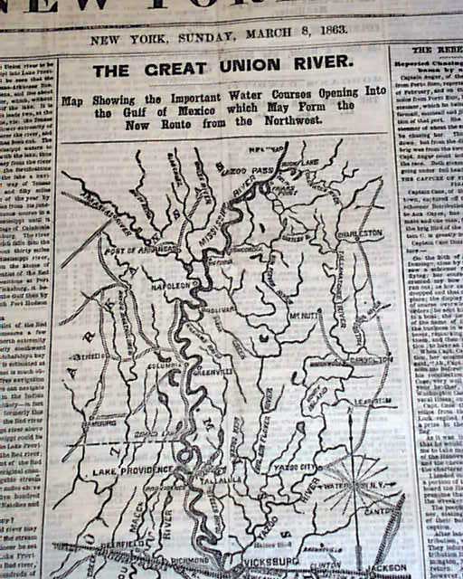
NEW YORK HERALD, March 8, 1863 The front page features a large map headed: "THE GREAT UNION RIVER..." showing the Mississippi and tributaries from Moon...
Mar 1863
$43
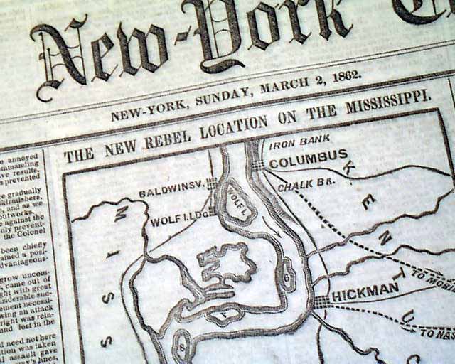
Map of rebel locations on the Mississippi River...
NEW YORK TIMES, March 2, 1862 The front page features a Civil War map headed: "The New Rebel Location on the Mississippi" at the border of Kentucky &...
Mar 1862
$55
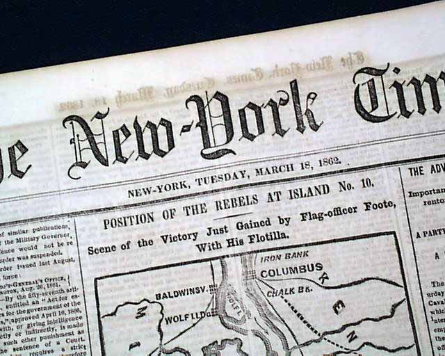
Map of the Mississippi River...
THE NEW YORK TIMES, New York City, New York, March 18, 1862
* Island No. 10
* Mississippi River
* New Madrid, Missouri
* Columbus Kentucky
The...
* Island No. 10
* Mississippi River
* New Madrid, Missouri
* Columbus Kentucky
The...
Mar 1862
$18