Home > Back to Search Results >
Map of the Island of Martinique... Early American Indians...

Map of the Island of Martinique... Early American Indians...
Item # 667355
Currently Unavailable. Contact us if you would like to be placed on a want list or to be notified if a similar item is available.
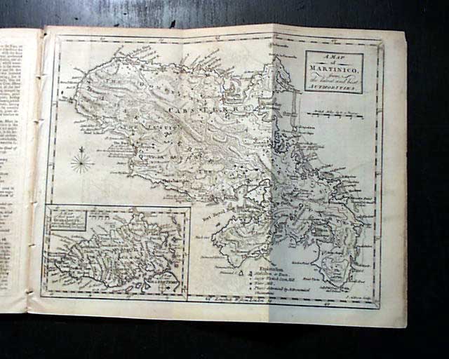
THE GENTLEMAN'S MAGAZINE, London, March, 1759 Certainly the prime content is the very nice foldout map titled: "A Map of Martinico from the latest & best Authorities." with an inset labeled: "A Map of that Part of Guadaloupe where the English made their Defense, Jan. 23, 1759."The map shows considerable detail and measures 8 1/4 by 10 1/4 inches and is in great condition. There is a related article titled: "Description of Guadaloupe" as noted in the table of contents.
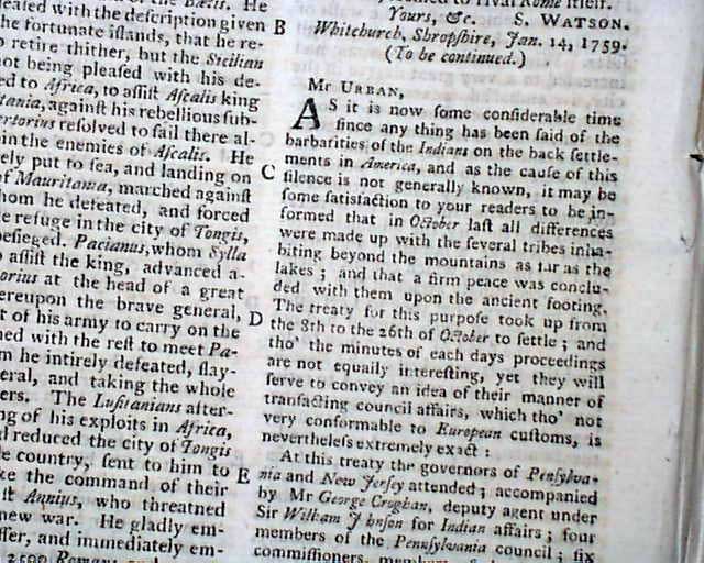
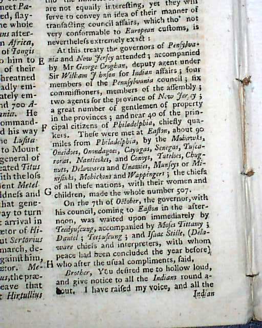
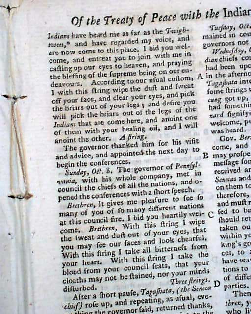
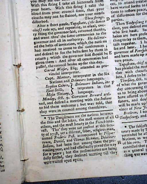
Another notable item is a report on a treaty with the Indians in Easton, Pennsylvania. The article takes the equivalent of a nearly a full page and includes: "...At this treaty the governors of Pennsylvania & New Jersey attended...These were met at Easton, about 90 miles from Philadelphia by the Mohawks, Oneidoes, Onondagoes, Cayugas, Senecas, Tuscaroras, Nanticokes, and Conoys, Tuteloes, Chugnuts, Delawares and Unamies, Munseys..." with more.
Complete in 48 pages, full title/contents page, 5 1/4 by 8 1/4 inches, very nice condition.
A very nice issue from during the French & Indian War with war-related content as well as other news of the day, political reports, literary items, and other unusual tidbits. This was the first periodical to use the word "magazine" in its title, having begun in 1731 and lasting until 1907.
Category: The 1600's and 1700's
No Longer Available