Home > Back to Search Results >
Fort Donelson, and two great Civil War maps...
Fort Donelson, and two great Civil War maps...
Item # 655018
Currently Unavailable. Contact us if you would like to be placed on a want list or to be notified if a similar item is available.
March 15, 1862
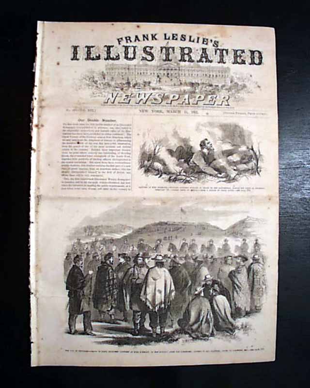
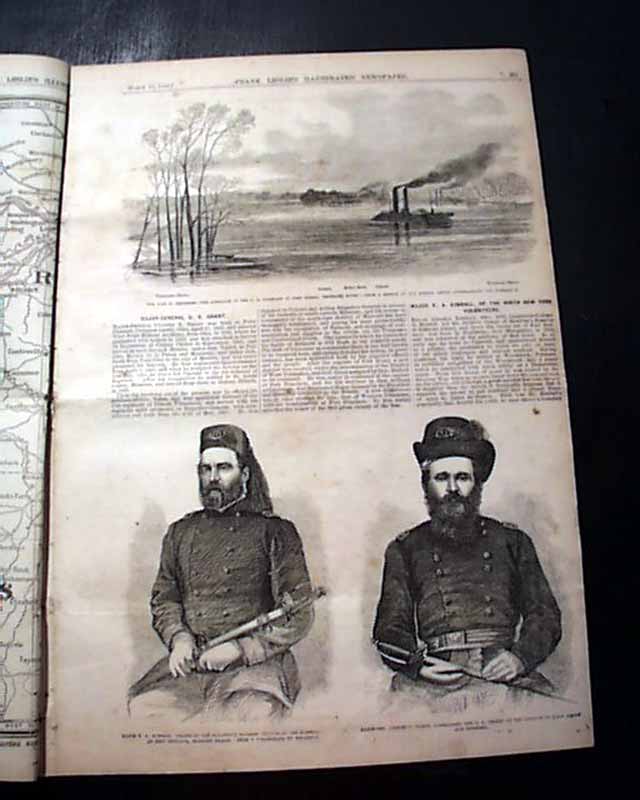
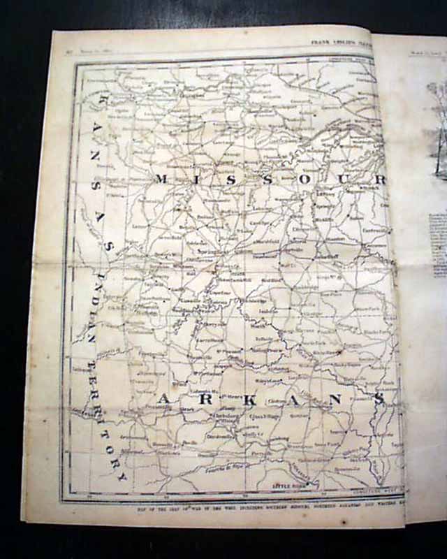
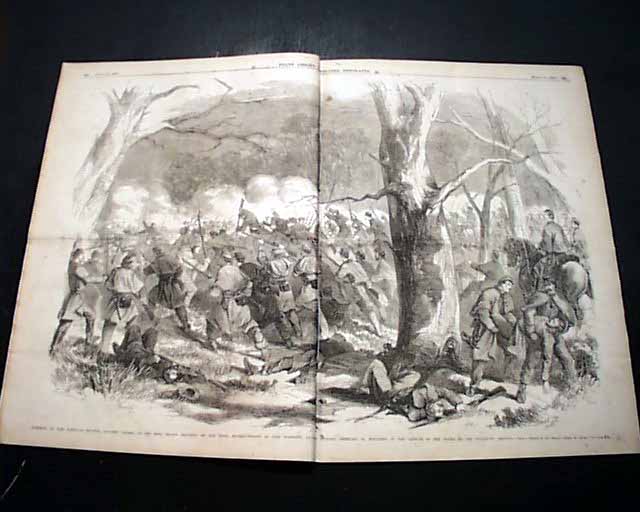
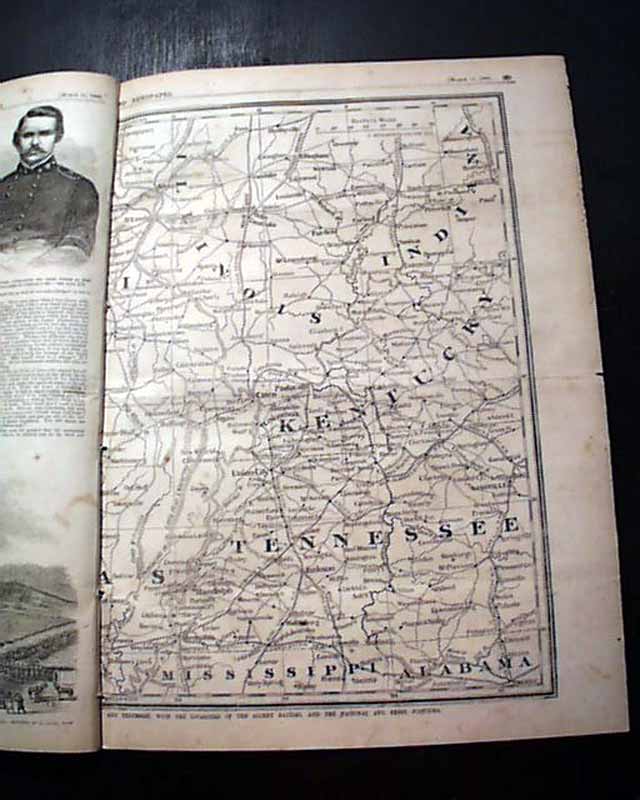
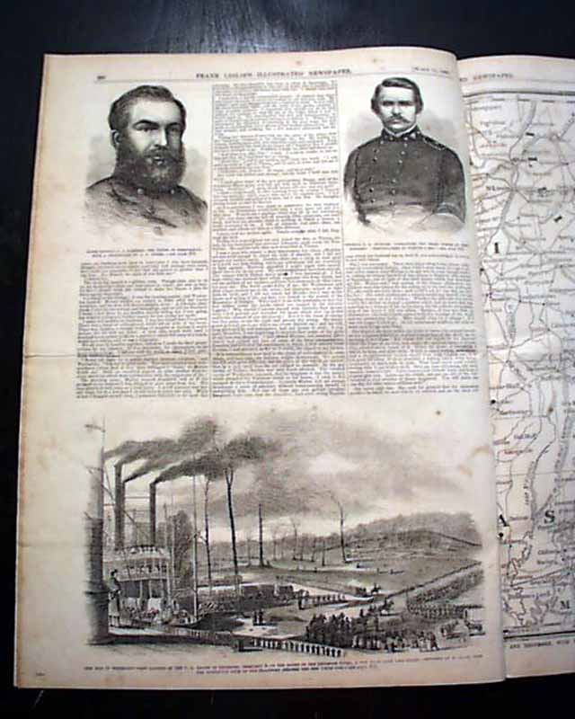
FRANK LESLIE'S ILLUSTRATED, New York, March 15, 1862 The front page has: "The War In Tennessee--Group of Rebel Prisoners Captured at Fort Donelson". Other prints within including: "Major-Gen. Ulysses S. Grant..." "Approach of the U.S. Gunboats to Fort Henry, Tenn. River", a terrific & very dramatic centerfold: "Storming of Fort Donelson...". Also a: "Map of Roanoke Island..." and a doublepage: "Map of the Seat of War in the West..." showing parts of Arkansas, Mississippi, Alabama, Tennessee, Kentucky, Illinois, Indiana & Missouri.
Sixteen pages, irregular at the blank spine, various foxing.
Category: Yankee
No Longer Available