Home > Back to Search Results >
Detailed map of New Orleans from 1849...
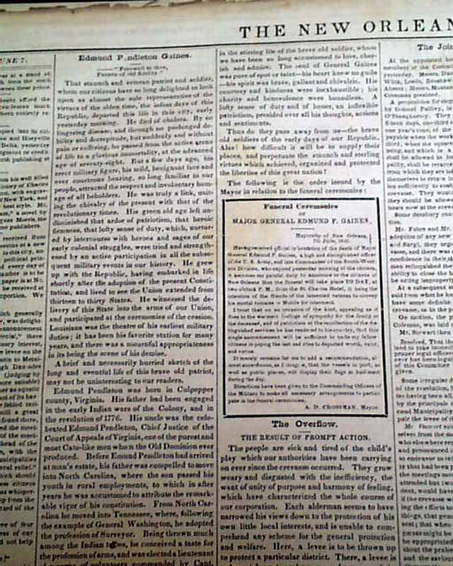
Detailed map of New Orleans from 1849...
Item # 644139
Currently Unavailable. Contact us if you would like to be placed on a want list or to be notified if a similar item is available.
June 11, 1849
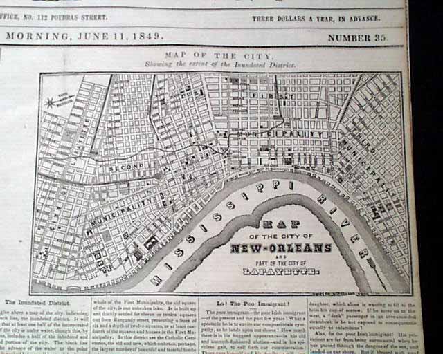
NEW ORLEANS WEEKLY DELTA, Louisiana, June 11, 1849 The front page features a very nice & detailed: "Map Of the City, Showing the Extent of the Inundated District". Included is lengthy text on the flood, noting that half of the limits of the city are under water. A great map of New Orleans from before the Civil War.
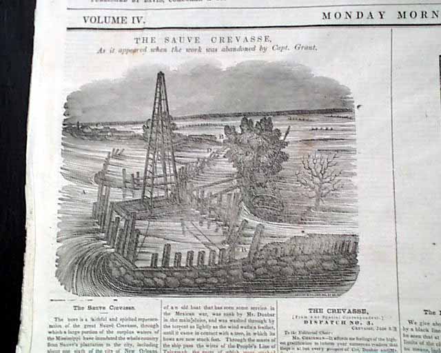
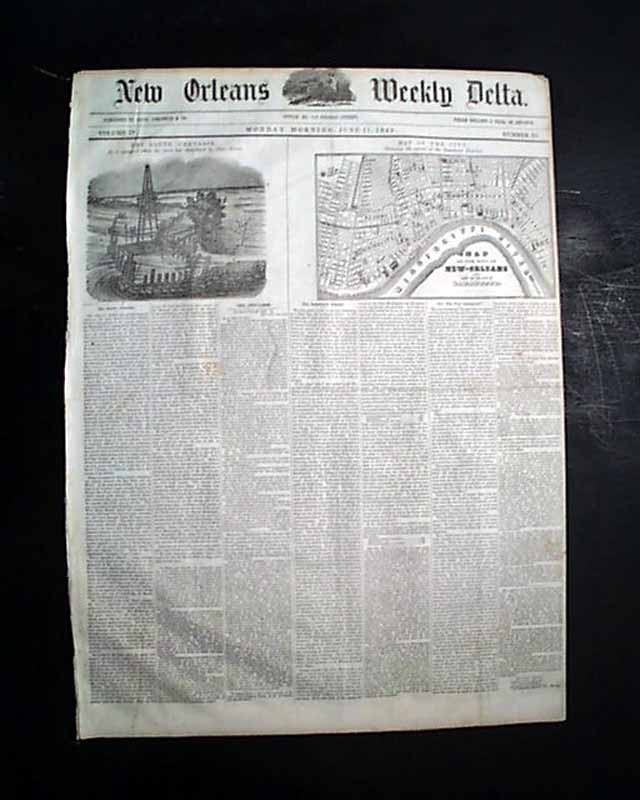
Also, the ftpg. has a print of: "The Sauve Crevasse, As it Appeared When the Work was Abandoned by Capt. Grant" with a lengthy article on it as well.
Inside has reports on the death & funeral for General Edmund P. Gaines. Eight pages, one inside leaf is close-trimmed at the margin with text loss but not to mentioned articles, nice condition.
Category: Pre-Civil War
No Longer Available