

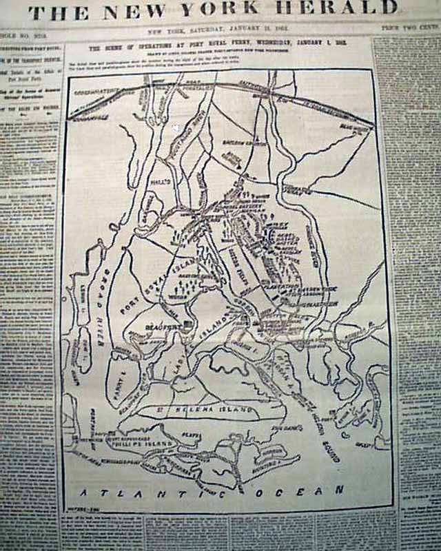
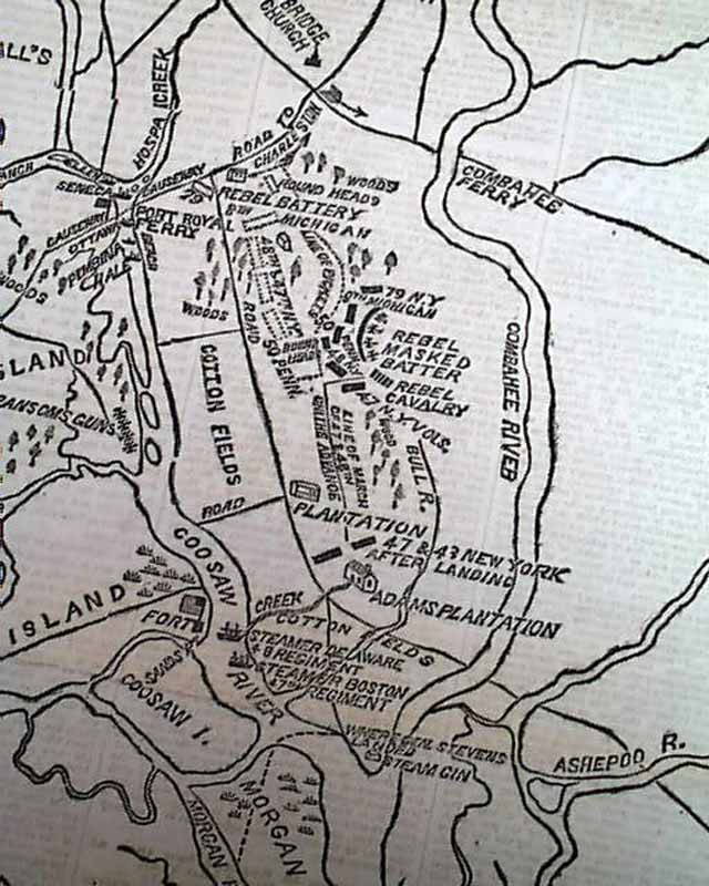
Very large Civil War map show the Beaufort vicinity...
Item # 574579
·
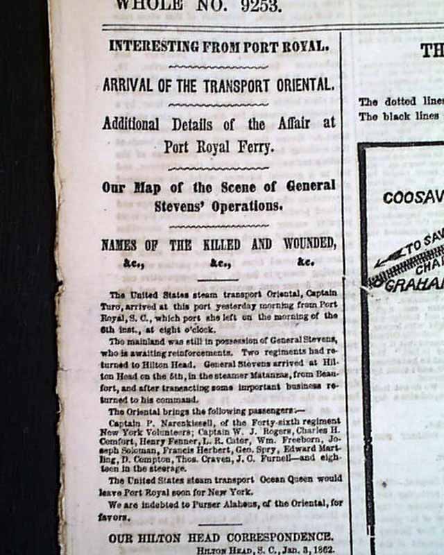
THE NEW YORK HERALD, Jan. 11, 1862 Most of the front page is taken up with a huge Civil War map headed: "The Scene Of Operations at Port Royal Ferry..." with a subhead. The map shows much detail of the Beaufort vicinity. There are also first column heads: "Additional Details of the Affair at Port Royal Ferry" and "Our Map of the Scene of General Stevens' Operations" & others (see).
Eight pages, various chipping at the margins with some minor margin tears as well, otherwise very nice condition.
Eight pages, various chipping at the margins with some minor margin tears as well, otherwise very nice condition.
Category: Yankee
Price
$46
100% Authentic: Original printing, never a reproduction.
Other issues you may like
§ related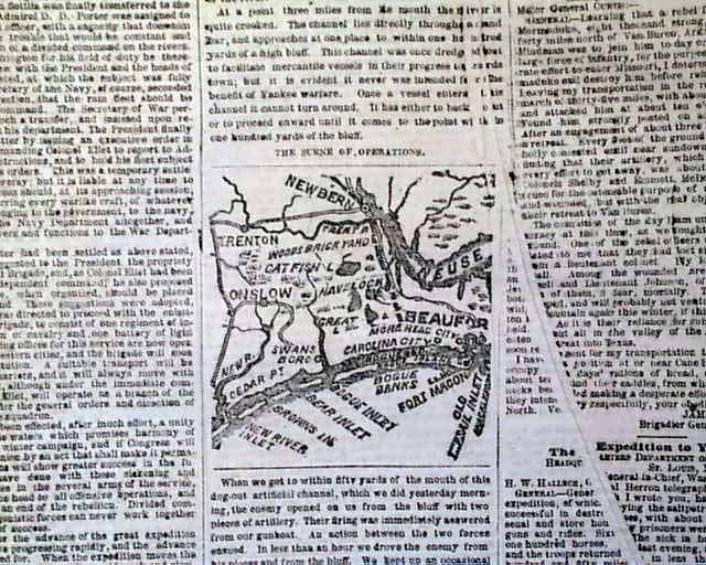
Small Civil War map on the front page...
NEW YORK HERALD, Dec. 4, 1862 The ftpg. has a small, one column head of a map of the New Bern and Beaufort area (see). Various column heads on the Civil...
Dec 1862
$26
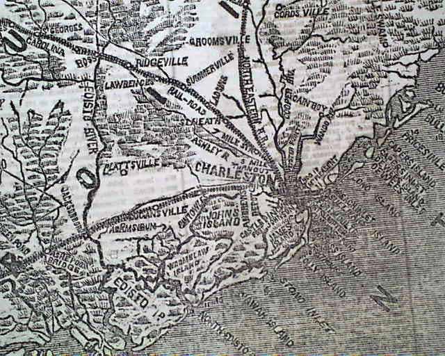
Map of Charleston, South Carolina...
NEW YORK HERALD, Jan. 5, 1862 The front page features a large Civil War map headed: "IMPORTANT MOVEMENTS NEAR CHARLESTON, S. C." Among the one column...
Jan 1862
$55
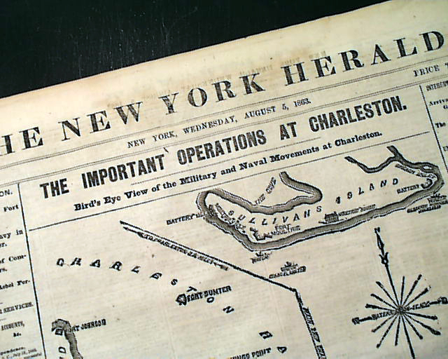
Huge Civil War map of Charleston harbor...
THE NEW YORK HERALD, Aug. 5, 1863
* Charleston, South Carolina Harbor map
The front page features a huge Civil War map headed: "THE IMPORTANT...
* Charleston, South Carolina Harbor map
The front page features a huge Civil War map headed: "THE IMPORTANT...
Aug 1863
$64
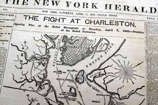
Huge Civil War map on the front page...
NEW YORK HERALD, April 11, 1863
* First Battle of Charleston Harbor
The front page is dominated by a huge Civil War map headed: "THE FIGHT AT CHARLESTON -...
* First Battle of Charleston Harbor
The front page is dominated by a huge Civil War map headed: "THE FIGHT AT CHARLESTON -...
Apr 1863
$33