
Four great maps...
Item # 569766Sorry, but this item is no longer available. Please be in touch at info@rarenewspapers.com if you would like to be placed on a want list or are interested in a potential alternate issue.
GENTLEMAN'S MAGAZINE, London, England, December, 1758
* 4 nice 18th century maps
* French and Indian War era
A very nice magazine from during the French & Indian War from the "mother country" with a wide range of varied content including news of the day, political reports, literary items, and other unusual tidbits. This was the first periodical to use the word "magazine" in its title, having begun in 1731 and lasting until 1907.
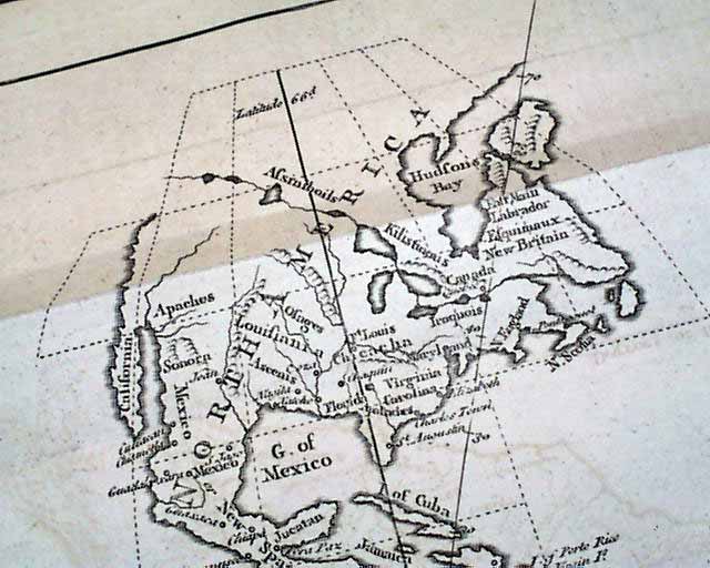
The prime feature of this issue would be the four maps included, although only one is called for (other 3 meant for the Supplement). One is a very nice foldout map titled within the cartouche: "A Map of the New Continent According to its Greatest Diametrical length from the River la Plata to beyond the Lake of the Assimiboils" (see). This map shows both North and South America. North America is somewhat crudely done, particularly the West, obviously due to limited familiarity of that part of the world (see). This map measures 8 by 8 3/4 inches and is in great condition.
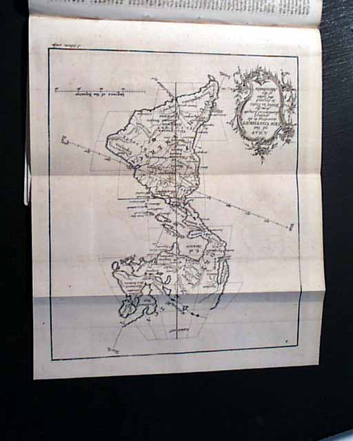
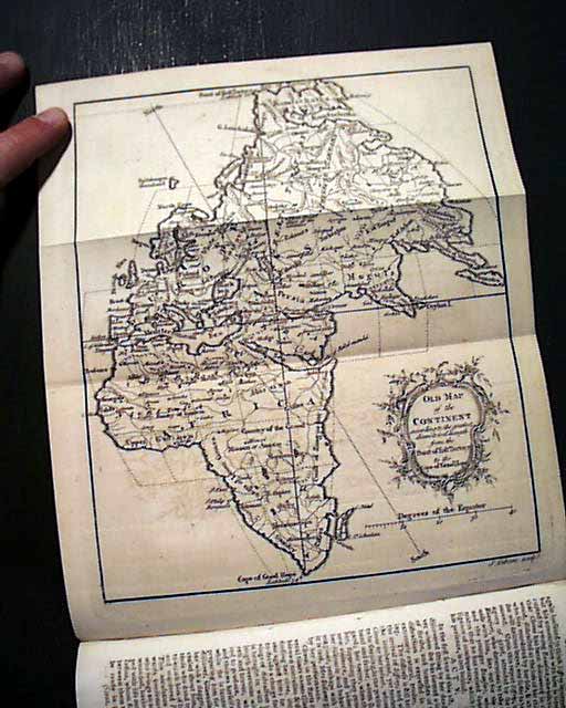
Another is an "Old Map of the Continent according to the greatest diametrical Length from the Post of East Tartary to the Cape of Good Hope" showing all of Africa, Europe, the Middle East, Asia and various islands. (Mislabeled as meant to be "Map of the Old Continent...") Measures 8 1/2 by 9 1/2 inches and is in great condition.
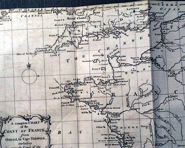
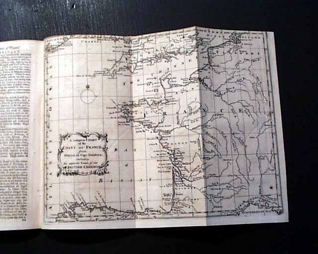
The third map not called for is: "A Complete Chart of the Coast of France from Ostend to Cape Finistrerr, including the Opposite Coast of the British Channel", folding out to 8 1/4 by 10 1/4 inches. Great condition but close-trimmed at part of the top causing minor loss to part of the border (see).
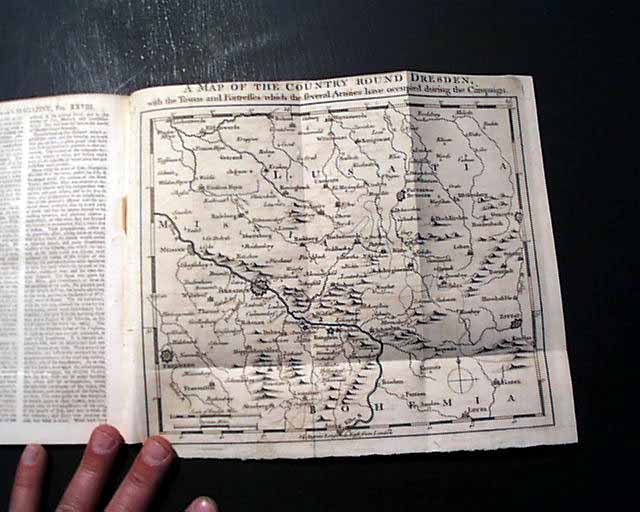
The map actually called for in this issue is: "A Map of the Country Round Dresden, with the towns and fortresses..." showing a portion of present-day Germany. It folds out to 8 1/2 by 9 1/2 inches and is in very nice condition.
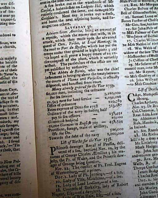
Near the back is the "Historical Chronicle" which has various news events of the day. Included is a report noting: "Advices from America bring an account of a repulse, which the enemy met with, in an attack which they made upon the advanced guard of Gen. Forbes at Loyal Hanning, in the road to Fort du Quesne...happy omen of an entire conquest of the place, which is earnestly wished..." with just a bit more (see).
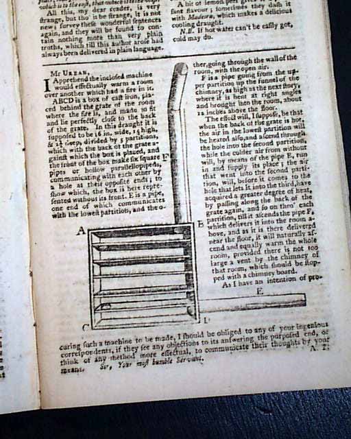
Other articles of interest within this issue include: "The Geography of the Earth Considered in a New Light with a View to Future Discoveries" "Description of the Maritime Towns of France" and "Machine for Warming Upper Chambers" which includes an engraving of it (see).
Complete in 46 pages, measures 5 by 8 inches with a full title/contents page which includes an engraving of St. John's Gate. Very nice, clean condition.
* 4 nice 18th century maps
* French and Indian War era
A very nice magazine from during the French & Indian War from the "mother country" with a wide range of varied content including news of the day, political reports, literary items, and other unusual tidbits. This was the first periodical to use the word "magazine" in its title, having begun in 1731 and lasting until 1907.
The prime feature of this issue would be the four maps included, although only one is called for (other 3 meant for the Supplement). One is a very nice foldout map titled within the cartouche: "A Map of the New Continent According to its Greatest Diametrical length from the River la Plata to beyond the Lake of the Assimiboils" (see). This map shows both North and South America. North America is somewhat crudely done, particularly the West, obviously due to limited familiarity of that part of the world (see). This map measures 8 by 8 3/4 inches and is in great condition.
Another is an "Old Map of the Continent according to the greatest diametrical Length from the Post of East Tartary to the Cape of Good Hope" showing all of Africa, Europe, the Middle East, Asia and various islands. (Mislabeled as meant to be "Map of the Old Continent...") Measures 8 1/2 by 9 1/2 inches and is in great condition.
The third map not called for is: "A Complete Chart of the Coast of France from Ostend to Cape Finistrerr, including the Opposite Coast of the British Channel", folding out to 8 1/4 by 10 1/4 inches. Great condition but close-trimmed at part of the top causing minor loss to part of the border (see).
The map actually called for in this issue is: "A Map of the Country Round Dresden, with the towns and fortresses..." showing a portion of present-day Germany. It folds out to 8 1/2 by 9 1/2 inches and is in very nice condition.
Near the back is the "Historical Chronicle" which has various news events of the day. Included is a report noting: "Advices from America bring an account of a repulse, which the enemy met with, in an attack which they made upon the advanced guard of Gen. Forbes at Loyal Hanning, in the road to Fort du Quesne...happy omen of an entire conquest of the place, which is earnestly wished..." with just a bit more (see).
Other articles of interest within this issue include: "The Geography of the Earth Considered in a New Light with a View to Future Discoveries" "Description of the Maritime Towns of France" and "Machine for Warming Upper Chambers" which includes an engraving of it (see).
Complete in 46 pages, measures 5 by 8 inches with a full title/contents page which includes an engraving of St. John's Gate. Very nice, clean condition.
Category: The 1600's and 1700's
