
Actual Mexican War map...
Item # 561605Sorry, but this item is no longer available. Please be in touch at info@rarenewspapers.com if you would like to be placed on a want list or are interested in a potential alternate issue.
August 20, 1847
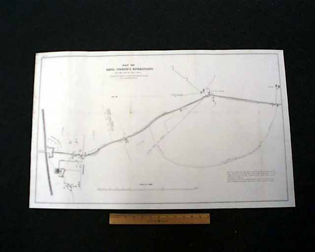
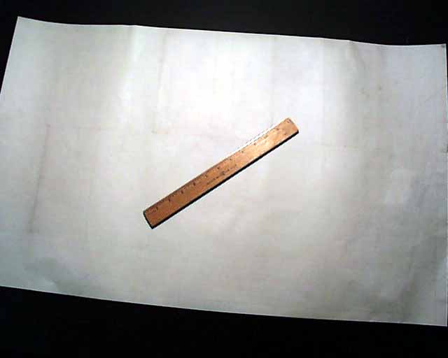
MEXICAN WAR MAP A very unusual item, being a large-size, measuring 20 by 32 1/2 inches, map titled:
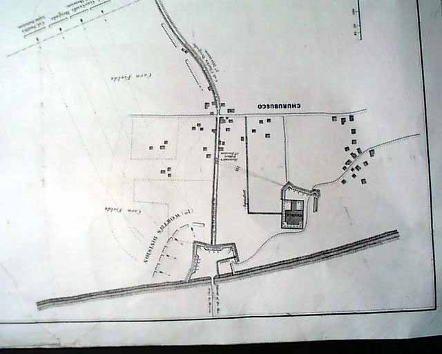
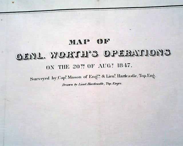
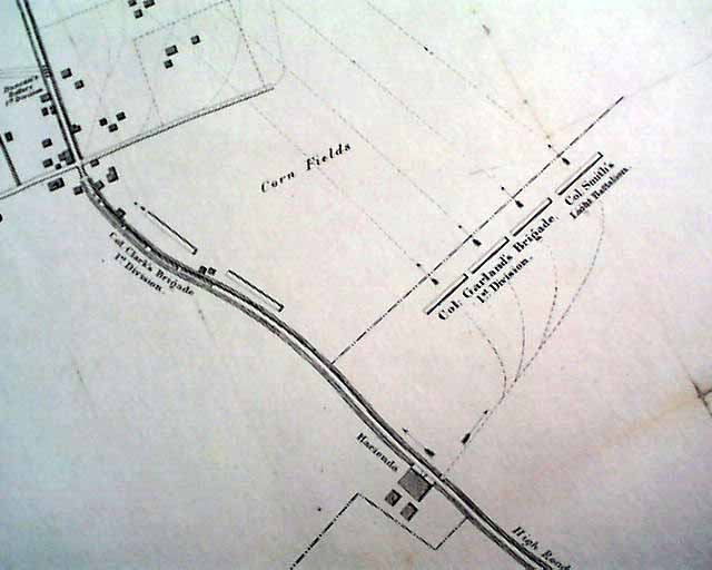
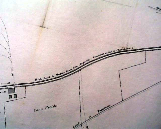
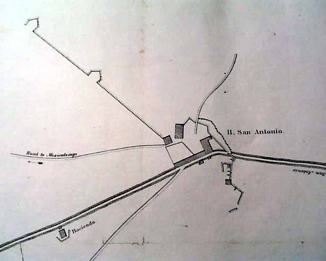
* Map of Genl. Worth's Operations on the 20th of Aug. 1847
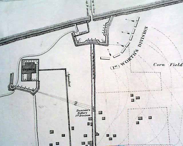
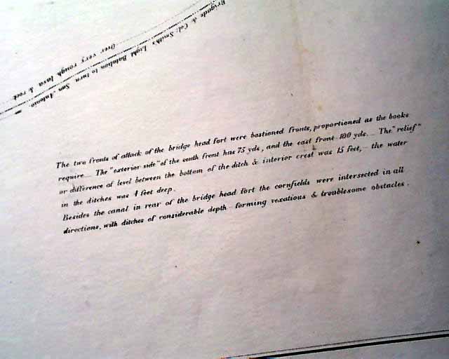
which shows the vicinity form San Antonio (Mexico) to Churubusco including some nice details. The inset in the lower right notes in part: "The two fronts of attack of the bridge head fort were bastioned fronts, proportioned as the books require. The 'Exterior side' of the south front has 75 yds. & the east from 100 yds..." with more (see).
The paper upon which this map is printed is of heavier stock than normal and has an archival overlay on the back for added strength & protection. There was a tear which was archivally repaired and is almost unnoticeable. Still quite white and in very nice condition.
We once had many of these maps which were individually numbered & taken from a much larger inventory, but this is our last in stock.
* Map of Genl. Worth's Operations on the 20th of Aug. 1847
which shows the vicinity form San Antonio (Mexico) to Churubusco including some nice details. The inset in the lower right notes in part: "The two fronts of attack of the bridge head fort were bastioned fronts, proportioned as the books require. The 'Exterior side' of the south front has 75 yds. & the east from 100 yds..." with more (see).
The paper upon which this map is printed is of heavier stock than normal and has an archival overlay on the back for added strength & protection. There was a tear which was archivally repaired and is almost unnoticeable. Still quite white and in very nice condition.
We once had many of these maps which were individually numbered & taken from a much larger inventory, but this is our last in stock.
Category: Pre-Civil War
